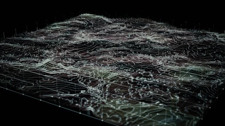
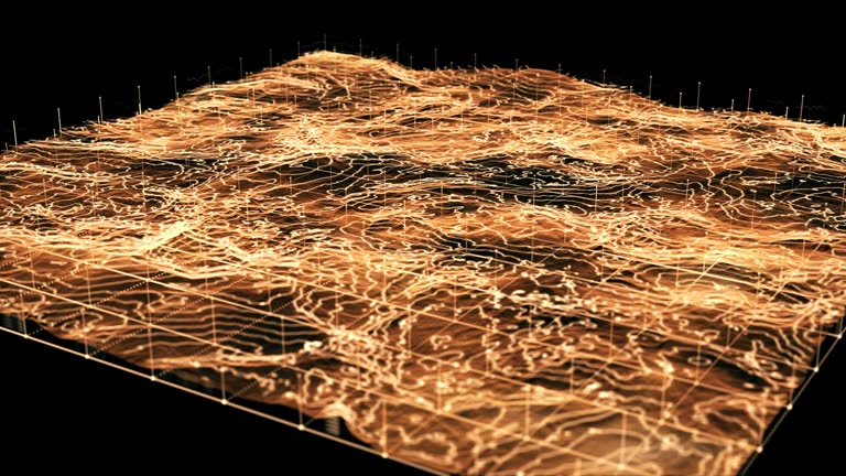
futuristic holographic terrain head up display, 3d landscape topography, futuristic user interface - topographic survey stock videos & royalty-free footage00:30Futuristic Holographic Terrain Head Up Display, 3D Landscape Topography, Futuristic User InterfaceGeology, 3D Animation, Surveyor
[m] futuristic holographic terrain, 3d landscape topography, futuristic user interface - topographic survey stock videos & royalty-free footage00:16[M] Futuristic Holographic Terrain, 3D Landscape Topography, Futuristic User InterfaceGeology, Mountain, Wire-frame Model
futuristic holographic terrain head up display, 3d landscape topography, futuristic user interface - topographic survey stock videos & royalty-free footage00:30Futuristic Holographic Terrain Head Up Display, 3D Landscape Topography, Futuristic User InterfaceSurveyor, Geology, Grid Pattern
[m] futuristic holographic terrain, 3d landscape topography, futuristic user interface - topographic survey stock videos & royalty-free footage00:16[M] Futuristic Holographic Terrain, 3D Landscape Topography, Futuristic User InterfaceMap, Green Color, Abstract
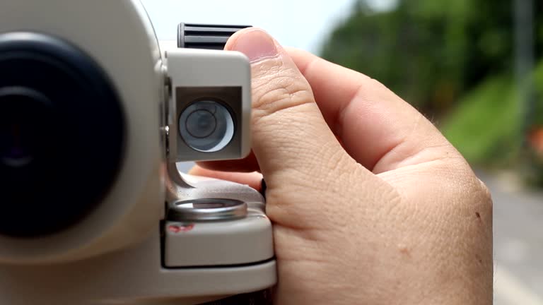
surveyor technician looks through a theodolite to level land for a wind turbine base in a power generation area. - topographic survey stock videos & royalty-free footage00:21surveyor technician looks through a theodolite to level land for a wind turbine base in a power generation area.Road Construction, Topography, Surveyor
[m] futuristic holographic terrain, 3d landscape topography, futuristic user interface - topographic survey stock videos & royalty-free footage00:16[M] Futuristic Holographic Terrain, 3D Landscape Topography, Futuristic User InterfaceTopography, 3D Animation, Three Dimensional
[m] futuristic holographic terrain, 3d landscape topography, futuristic user interface - topographic survey stock videos & royalty-free footage00:16[M] Futuristic Holographic Terrain, 3D Landscape Topography, Futuristic User InterfaceSurveillance, Topography, Topographic Map
[m] futuristic holographic terrain, 3d landscape topography, futuristic user interface - topographic survey stock videos & royalty-free footage00:16[M] Futuristic Holographic Terrain, 3D Landscape Topography, Futuristic User InterfaceSurveyor, Land, Digitally Generated Image
surveyor technician looks through a theodolite to level land for a wind turbine base in a power generation area. - topographic survey stock videos & royalty-free footage00:23surveyor technician looks through a theodolite to level land for a wind turbine base in a power generation area.Civil Engineering, Topography, Surveyor
surveyor technician looks through a theodolite to level land for a wind turbine base in a power generation area. - topographic survey stock videos & royalty-free footage00:26surveyor technician looks through a theodolite to level land for a wind turbine base in a power generation area.Civil Engineering, Road Construction, Surveyor
[m] futuristic holographic terrain, 3d landscape topography, futuristic user interface - topographic survey stock videos & royalty-free footage00:16[M] Futuristic Holographic Terrain, 3D Landscape Topography, Futuristic User InterfaceTopography, Map, Topographic Map
surveyor or engineer operating theodolite a precision instrument a tripod measuring background construction large piles of dirt and heavy machinery, including excavators the field of civil engineering and land development. - topographic survey stock videos & royalty-free footage00:16Surveyor or Engineer operating theodolite a precision instrument a tripod measuring background construction large piles of dirt and heavy machinery, including excavators the field of civil engineering and land development.Surveyor, Questionnaire, Construction Site
[m] futuristic holographic terrain, 3d landscape topography, futuristic user interface - topographic survey stock videos & royalty-free footage00:16[M] Futuristic Holographic Terrain, 3D Landscape Topography, Futuristic User InterfaceTopography, Three Dimensional, 3D Animation
[m] futuristic holographic terrain, 3d landscape topography, futuristic user interface - topographic survey stock videos & royalty-free footage00:10[M] Futuristic Holographic Terrain, 3D Landscape Topography, Futuristic User InterfaceOutline, Heads Up Display - Video Game
[m] futuristic holographic terrain, 3d landscape topography, futuristic user interface - topographic survey stock videos & royalty-free footage00:10[M] Futuristic Holographic Terrain, 3D Landscape Topography, Futuristic User Interface3D Animation, Three Dimensional, Topography
portrait of caucasian civil engineer using a survey telescope to measure the level on construction site to plan the house project. - topographic survey stock videos & royalty-free footage00:11Portrait of Caucasian civil engineer using a survey telescope to measure the level on construction site to plan the house project.Surveyor, Females, Construction Industry
worker use surveyor’s telescope at new road construction site - topographic survey stock videos & royalty-free footage00:25worker use surveyor’s telescope at new road construction siteRoad, Surveyor, Land
a young technician looks through a theodolite to level land for a wind turbine base in a power generation area. - topographic survey stock videos & royalty-free footage00:19A young technician looks through a theodolite to level land for a wind turbine base in a power generation area.Surveyor, Construction Site, Wind Turbine
futuristic holographic terrain head up display, 3d landscape topography, futuristic user interface - topographic survey stock videos & royalty-free footage00:30Futuristic Holographic Terrain Head Up Display, 3D Landscape Topography, Futuristic User InterfaceDigitally Generated Image, Digital Display, Technology
futuristic holographic terrain head up display, 3d landscape topography, futuristic user interface - topographic survey stock videos & royalty-free footage00:30Futuristic Holographic Terrain Head Up Display, 3D Landscape Topography, Futuristic User InterfaceTopographic Map, Three Dimensional, 3D Animation
engineer is using a survey camera to measure levels on a construction site. - topographic survey stock videos & royalty-free footage00:10engineer is using a survey camera to measure levels on a construction site.Surveyor, Land
technicians are looking at a survey camera in a wind turbine farm to measure the height of the area in order to build a wind turbine to produce electricity, a green energy concept. - topographic survey stock videos & royalty-free footage00:06Technicians are looking at a survey camera in a wind turbine farm to measure the height of the area in order to build a wind turbine to produce electricity, a green energy concept.Surveyor, Land
road survey engineer and surveyor’s telescope at new road construction site - topographic survey stock videos & royalty-free footage00:27Road survey engineer and surveyor’s telescope at new road construction siteTopography, Surveyor
[m] futuristic holographic terrain, 3d landscape topography, futuristic user interface - topographic survey stock videos & royalty-free footage00:10[M] Futuristic Holographic Terrain, 3D Landscape Topography, Futuristic User InterfaceMap, Topography, Virtual Reality Simulator
engineer working at renewable energy site wind turbines examining blueprint surveying instrument mounted tripod ensuring accurate land measurements practices in environmental industrial. - topographic survey stock videos & royalty-free footage00:20Engineer working at renewable energy site wind turbines examining blueprint surveying instrument mounted tripod ensuring accurate land measurements practices in environmental industrial.Engineering, Surveyor, Construction Site
surveyor or engineer operating theodolite a precision instrument a tripod measuring background construction large piles of dirt and heavy machinery, including excavators the field of civil engineering and land development. - topographic survey stock videos & royalty-free footage00:11Surveyor or Engineer operating theodolite a precision instrument a tripod measuring background construction large piles of dirt and heavy machinery, including excavators the field of civil engineering and land development.Surveyor, Land, Questionnaire
surveyor technician looks through a theodolite to level land for a wind turbine base in a power generation area. - topographic survey stock videos & royalty-free footage00:14surveyor technician looks through a theodolite to level land for a wind turbine base in a power generation area.Surveyor, Theodolite
residential construction is booming in los angeles and new development sites come up on a regular basis - topographic survey stock videos & royalty-free footage00:28Land Surveyor construction worker working with theodolite level tool in Los Angeles, California, 4KSurveyor
echnicians are using a surveying instrument to measure the distance of a road construction project in the wind farm area.(vdo 4k) - topographic survey stock videos & royalty-free footage00:18echnicians are using a surveying instrument to measure the distance of a road construction project in the wind farm area.(VDO 4K)
echnicians are using a surveying instrument to measure the distance of a road construction project in the wind farm area.(vdo 4k) - topographic survey stock videos & royalty-free footage00:18echnicians are using a surveying instrument to measure the distance of a road construction project in the wind farm area.(VDO 4K)
[m] futuristic holographic terrain, 3d landscape topography, futuristic user interface - topographic survey stock videos & royalty-free footage00:10[M] Futuristic Holographic Terrain, 3D Landscape Topography, Futuristic User Interface
surveyor measuring and checking blueprints on a building construction site. engineering and land surveying for express way development - topographic survey stock videos & royalty-free footage00:21Surveyor measuring and checking blueprints on a building construction site. Engineering and land surveying for Express way developmentSurveyor, Road, City
two civil engineers conduct a land survey at a pipeline construction site using a theodolite - topographic survey stock videos & royalty-free footage00:11Two civil engineers conduct a land survey at a pipeline construction site using a theodoliteSurveyor, Archaeology
male engineer using measuring equipment level theodolite the senior male engineer in a white helmet on a construction site using a theodolite marks the coordinates of a concrete pile. geodetic measurements. - topographic survey stock videos & royalty-free footage00:17Male Engineer Using Measuring Equipment Level Theodolite The senior male engineer in a white helmet on a construction site using a theodolite marks the coordinates of a concrete pile. Geodetic measurements.Surveyor, Land
surveyor or engineer operating theodolite a precision instrument a tripod measuring background construction large piles of dirt and heavy machinery, including excavators the field of civil engineering and land development. - topographic survey stock videos & royalty-free footage00:14Surveyor or Engineer operating theodolite a precision instrument a tripod measuring background construction large piles of dirt and heavy machinery, including excavators the field of civil engineering and land development.Surveyor, Land
two caucasian civil engineers are looking at a construction plan on a tablet. - topographic survey stock videos & royalty-free footage00:17Two Caucasian civil engineers are looking at a construction plan on a tablet.Surveyor, Teamwork, Examining
futuristic holographic terrain head up display, 3d landscape topography, futuristic user interface - topographic survey stock videos & royalty-free footage00:30Futuristic Holographic Terrain Head Up Display, 3D Landscape Topography, Futuristic User InterfaceWire-frame Model, Augmented Reality, Artificial Intelligence
surveyor’s telescope at new road construction site - topographic survey stock videos & royalty-free footage00:22Surveyor’s telescope at new road construction siteSurveyor, Topography, Theodolite
road survey engineer adjustable surveyor’s telescope at new road construction site - topographic survey stock videos & royalty-free footage00:27Road survey engineer adjustable surveyor’s telescope at new road construction siteRoad, Surveyor, Land
[m] futuristic holographic terrain, 3d landscape topography, futuristic user interface - topographic survey stock videos & royalty-free footage00:10[M] Futuristic Holographic Terrain, 3D Landscape Topography, Futuristic User InterfaceThree Dimensional, 3D Animation, Artificial Intelligence
[m] futuristic holographic terrain, 3d landscape topography, futuristic user interface - topographic survey stock videos & royalty-free footage00:10[M] Futuristic Holographic Terrain, 3D Landscape Topography, Futuristic User InterfaceThree Dimensional, Data, 3D Animation
surveyor measuring and checking blueprints on a building construction site. engineering and land surveying for express way development - topographic survey stock videos & royalty-free footage00:19Surveyor measuring and checking blueprints on a building construction site. Engineering and land surveying for Express way developmentLand, Surveyor
surveyor measuring and checking blueprints on a building construction site. engineering and land surveying for express way development - topographic survey stock videos & royalty-free footage00:21Surveyor measuring and checking blueprints on a building construction site. Engineering and land surveying for Express way development
surveyor measuring and checking blueprints on a building construction site. engineering and land surveying for express way development - topographic survey stock videos & royalty-free footage00:21Surveyor measuring and checking blueprints on a building construction site. Engineering and land surveying for Express way developmentCity, Repairing, Road
surveyor measuring and checking blueprints on a building construction site. engineering and land surveying for express way development - topographic survey stock videos & royalty-free footage00:13Surveyor measuring and checking blueprints on a building construction site. Engineering and land surveying for Express way developmentTheodolite, Topography
male and female construction or civil engineering workers, wearing safety vest and helmets standing beside a tripod-mounted surveying instrument are inspecting blueprints at a construction site, infrastructure project - topographic survey stock videos & royalty-free footage00:10Male and Female construction or civil engineering workers, wearing safety vest and helmets standing beside a tripod-mounted surveying instrument are inspecting blueprints at a construction site, infrastructure projectBlueprint, Architecture, Road
woman and man civil engineer survey in construction site - topographic survey stock videos & royalty-free footage00:12Woman and man civil engineer survey in construction siteSurveyor, Road
two engineers walking through construction site side by side - topographic survey stock videos & royalty-free footage00:10Two engineers walking through construction site side by sideSafety, Discussion, Topography
surveyor or engineer operating theodolite a precision instrument a tripod measuring background construction large piles of dirt and heavy machinery, including excavators the field of civil engineering and land development. - topographic survey stock videos & royalty-free footage00:14Surveyor or Engineer operating theodolite a precision instrument a tripod measuring background construction large piles of dirt and heavy machinery, including excavators the field of civil engineering and land development.Surveyor, Land
[m] futuristic holographic terrain, 3d landscape topography, futuristic user interface - topographic survey stock videos & royalty-free footage00:16[M] Futuristic Holographic Terrain, 3D Landscape Topography, Futuristic User InterfaceMap, Heads Up Display - Video Game, Topographic Map
engineer survey the area for installing solar panel. - topographic survey stock videos & royalty-free footage00:25Engineer survey the area for installing solar panel.Topography, Theodolite
engineer survey the area for installing solar panel. - topographic survey stock videos & royalty-free footage00:33Engineer survey the area for installing solar panel.Surveyor
engineer is using a survey camera to measure levels on a construction site. - topographic survey stock videos & royalty-free footage00:15engineer is using a survey camera to measure levels on a construction site.Real Estate, Topography
technicians are looking at a survey camera in a wind turbine farm to measure the height of the area in order to build a wind turbine to produce electricity, a green energy concept. - topographic survey stock videos & royalty-free footage00:14Technicians are looking at a survey camera in a wind turbine farm to measure the height of the area in order to build a wind turbine to produce electricity, a green energy concept.Surveyor
futuristic holographic terrain head up display, 3d landscape topography, futuristic user interface - topographic survey stock videos & royalty-free footage00:30Futuristic Holographic Terrain Head Up Display, 3D Landscape Topography, Futuristic User InterfaceTopography
loopable, global compass rose, cardinal points, gps, survey, orienteering - topographic survey stock videos & royalty-free footage00:10Loopable, Global Compass Rose, Cardinal points, GPS, Survey, Orienteering
global compass - loop - topographic survey stock videos & royalty-free footage00:10Global Compass - Loop
loopable, global compass rose, cardinal points, gps, survey, orienteering - topographic survey stock videos & royalty-free footage00:10Loopable, Global Compass Rose, Cardinal points, GPS, Survey, OrienteeringTurning, Animated Video
loopable, europe focus, global compass - topographic survey stock videos & royalty-free footage00:10Loopable, Europe focus, Global CompassEast, Europe, Orienteering
loopable, global compass rose, cardinal points, gps, survey, orienteering - topographic survey stock videos & royalty-free footage00:10Loopable, Global Compass Rose, Cardinal points, GPS, Survey, Orienteering
loopable, global compass rose, cardinal points, gps, survey, orienteering - topographic survey stock videos & royalty-free footage00:10Loopable, Global Compass Rose, Cardinal points, GPS, Survey, OrienteeringBlue, Outer Space
road survey engineer adjustable surveyor’s telescope at new road construction site - topographic survey stock videos & royalty-free footage00:24Road survey engineer adjustable surveyor’s telescope at new road construction site
road survey engineer send signal to worker in new road construction site - topographic survey stock videos & royalty-free footage00:26Road survey engineer send signal to worker in new road construction site
pacific ocean floor three dimensional topography, relief map. vs peaks, plains, trenches, mountain ridge . geological, geology, survey. - topographic survey stock videos & royalty-free footage00:581969: OCEANOGRAPHY: SEAFLOOR TOPOGRAPHIC MAP: HD: CU ZO WS Pacific Ocean floor three dimensional (3D) topography, relief map. VS Peaks, plains, trenches, mountain ridge (4700 miles total). Geological, geology, survey.Trench, Sea
hd:navigator compass for explorer the world map - topographic survey stock videos & royalty-free footage00:09HD:Navigator compass for explorer the world map
hd:navigator compass for explorer the world map - topographic survey stock videos & royalty-free footage00:11HD:Navigator compass for explorer the world map
technicians are using surveying equipment to measure distances for a road and bridge construction project. (vdo 4k) - topographic survey stock videos & royalty-free footage00:16Technicians are using surveying equipment to measure distances for a road and bridge construction project. (VDO 4K)
civil engineers are using surveying equipment to measure distances for road and bridge construction projects. - topographic survey stock videos & royalty-free footage00:19Civil engineers are using surveying equipment to measure distances for road and bridge construction projects.
civil engineers are using surveying equipment to measure distances for road and bridge construction projects. - topographic survey stock videos & royalty-free footage00:18Civil engineers are using surveying equipment to measure distances for road and bridge construction projects.
civil engineers are using surveying equipment to measure distances for road and bridge construction projects. - topographic survey stock videos & royalty-free footage00:15Civil engineers are using surveying equipment to measure distances for road and bridge construction projects.
civil engineers are using surveying equipment to measure distances for road and bridge construction projects. - topographic survey stock videos & royalty-free footage00:16Civil engineers are using surveying equipment to measure distances for road and bridge construction projects.
civil engineers are using surveying equipment to measure distances for road and bridge construction projects. - topographic survey stock videos & royalty-free footage00:25Civil engineers are using surveying equipment to measure distances for road and bridge construction projects.
civil engineers are using surveying equipment to measure distances for road and bridge construction projects. - topographic survey stock videos & royalty-free footage00:17Civil engineers are using surveying equipment to measure distances for road and bridge construction projects.
civil engineers are using surveying equipment to measure distances for road and bridge construction projects. - topographic survey stock videos & royalty-free footage00:18Civil engineers are using surveying equipment to measure distances for road and bridge construction projects.
civil engineers are using surveying equipment to measure distances for road and bridge construction projects. - topographic survey stock videos & royalty-free footage00:12Civil engineers are using surveying equipment to measure distances for road and bridge construction projects.
civil engineers are using surveying equipment to measure distances for road and bridge construction projects. - topographic survey stock videos & royalty-free footage00:14Civil engineers are using surveying equipment to measure distances for road and bridge construction projects.
civil engineers are using surveying equipment to measure distances for road and bridge construction projects. - topographic survey stock videos & royalty-free footage00:18Civil engineers are using surveying equipment to measure distances for road and bridge construction projects.