rare and dangerous heat wave has spread across the eastern united states, placing more than 160 million people under heat alerts as major cities... - southeast usa map stock videos & royalty-free footage00:21MOTION GRAPHIC - Extreme heat wave grips eastern US with record-breaking temperaturesMap, USA, Chicago - Illinois
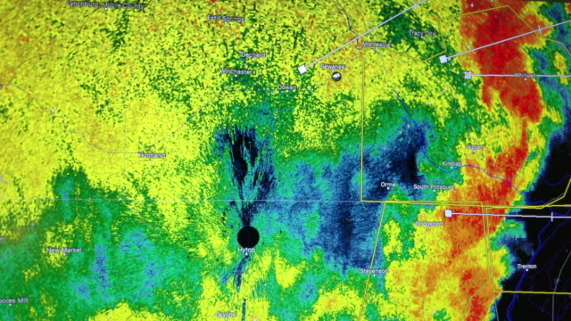
desktop computer weather radar app shows thunderstorms and tornado warning in jackson, mississippi - southeast usa map stock videos & royalty-free footage00:34Desktop Computer Weather Radar App Shows Thunderstorms And Tornado Warning In Jackson, MississippiRadar, Map, Motion
desktop computer weather radar app shows thunderstorms and tornado warning in brookhaven, mississippi - southeast usa map stock videos & royalty-free footage00:43Desktop Computer Weather Radar App Shows Thunderstorms And Tornado Warning In Brookhaven, MississippiClimate Change, Computer Graphic, USA
discovery and exploration - part 6 of 18. surveys the period of discovery and exploration in north america between 1492 and 1700. analyzes three motives for this exploration--to find a new trade route to the far east, to search for riches, and to find bea - southeast usa map stock videos & royalty-free footage00:31Discovery and Exploration - part 6 of 18. Surveys the period of discovery and exploration in North America between 1492 and 1700. Analyzes three motives for this exploration--to find a new trade route to the Far East, to search for riches, and to find beaMap, Archival, Inca
northwestern states (2nd edition) - part 4 of 19. represents the northwestern states as the "breadbasket of the nation" and stresses the importance of their agricultural and mineral resources. animated maps illustrate the region's geographical characteris - southeast usa map stock videos & royalty-free footage00:33Northwestern States (2nd edition) - part 4 of 19. Represents the Northwestern States as the "breadbasket of the nation" and stresses the importance of their agricultural and mineral resources. Animated maps illustrate the region's geographical characterisMap, Arrow Symbol, Old-fashioned
discovery and exploration - part 15 of 18. surveys the period of discovery and exploration in north america between 1492 and 1700. analyzes three motives for this exploration--to find a new trade route to the far east, to search for riches, and to find be - southeast usa map stock videos & royalty-free footage00:31Discovery and Exploration - part 15 of 18. Surveys the period of discovery and exploration in North America between 1492 and 1700. Analyzes three motives for this exploration--to find a new trade route to the Far East, to search for riches, and to find beIllinois, Mississippi River, Georgia - US State
weather radar shows thunderstorm moving in the southeast of america - southeast usa map stock videos & royalty-free footage00:12Weather radar shows thunderstorm moving in the southeast of America ( NO AUDIO )Weather, Meteorology, Forecasting
[from esso marketing film "rubber goes synthetic"] animated map showing philippine islands, borneo, celebes , java, sumatra, malaya, thailand, french... - southeast usa map stock videos & royalty-free footage00:54Esso marketing film showing map of Southeast Asia; USA map with statisticsMap, World War II, Indochina
southeastern states (2nd edition) - part 2 of 19. an overview of the geography, resources, and cultural patterns of the southeastern states. analyzes geographical features of the region; describes population trends; and shows the interdependence of the s - southeast usa map stock videos & royalty-free footage00:33Southeastern States (2nd edition) - part 2 of 19. An overview of the geography, resources, and cultural patterns of the Southeastern States. Analyzes geographical features of the region; describes population trends; and shows the interdependence of the SMap, Virginia - US State, Mississippi
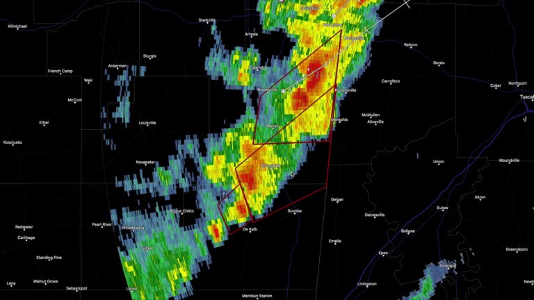
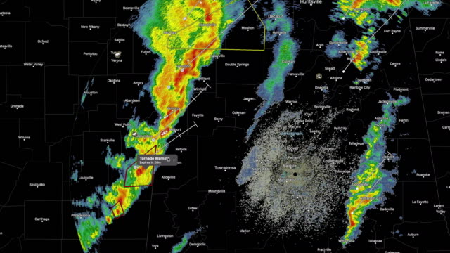
weather radar shows tornado warning in the southeast of america - southeast usa map stock videos & royalty-free footage00:16Weather radar shows tornado warning in the southeast of AmericaWeather, Data, Meteorology
desktop computer weather radar app shows rain developing in the southeast of america - southeast usa map stock videos & royalty-free footage00:12Desktop computer weather radar app shows rain developing in the southeast of AmericaRadar, Doppler, Weather
"paramount news issue no. 98"/ title card: "indo-china: armistice signing - eisenhower gives us reaction" superimposed over southeast asia map /... - southeast usa map stock videos & royalty-free footage02:03French Indochina armistice signed at the Geneva Conference; US Pres. Dwight Eisenhower reactionVietnam, Cambodia, France
desktop computer weather radar app shows thunderstorms and tornado warning in jackson, mississippi - southeast usa map stock videos & royalty-free footage00:41Desktop Computer Weather Radar App Shows Thunderstorms And Tornado Warning In Jackson, MississippiRadar, Doppler, Storm
examines the cultural, physical and economic geography of the countries of southeast asia. shows how the people through their emergence from colonial... - southeast usa map stock videos & royalty-free footage00:231970s: Man drives small forklift around port. Map of southeast AsiaThailand, Tourism, Map
discovery and exploration - part 7 of 18. surveys the period of discovery and exploration in north america between 1492 and 1700. analyzes three motives for this exploration--to find a new trade route to the far east, to search for riches, and to find bea - southeast usa map stock videos & royalty-free footage00:31Discovery and Exploration - part 7 of 18. Surveys the period of discovery and exploration in North America between 1492 and 1700. Analyzes three motives for this exploration--to find a new trade route to the Far East, to search for riches, and to find beaMap, 16th Century, Arizona
southeastern states (2nd edition) - part 18 of 19. an overview of the geography, resources, and cultural patterns of the southeastern states. analyzes geographical features of the region; describes population trends; and shows the interdependence of the - southeast usa map stock videos & royalty-free footage00:35Southeastern States (2nd edition) - part 18 of 19. An overview of the geography, resources, and cultural patterns of the Southeastern States. Analyzes geographical features of the region; describes population trends; and shows the interdependence of the1950-1959, Map, New Orleans
southeastern states (2nd edition) - part 16 of 19. an overview of the geography, resources, and cultural patterns of the southeastern states. analyzes geographical features of the region; describes population trends; and shows the interdependence of the - southeast usa map stock videos & royalty-free footage00:32Southeastern States (2nd edition) - part 16 of 19. An overview of the geography, resources, and cultural patterns of the Southeastern States. Analyzes geographical features of the region; describes population trends; and shows the interdependence of theUSA
southeastern states (2nd edition) - part 15 of 19. an overview of the geography, resources, and cultural patterns of the southeastern states. analyzes geographical features of the region; describes population trends; and shows the interdependence of the - southeast usa map stock videos & royalty-free footage00:28Southeastern States (2nd edition) - part 15 of 19. An overview of the geography, resources, and cultural patterns of the Southeastern States. Analyzes geographical features of the region; describes population trends; and shows the interdependence of theMap
severe flooding was seen in parts of atlanta, georgia, in the early morning hours of friday, september 27, as hurricane helene made landfall in... - southeast usa map stock videos & royalty-free footage01:21Person Floats on Air Mattress as Water Rescues Carried Out at Atlanta Apartment Complex2024 Hurricane Helene, Flood
weather radar shows tornado warning in the southeast of america - southeast usa map stock videos & royalty-free footage00:13Weather radar shows tornado warning in the southeast of AmericaRadar, Map, Tornado
governor of new york thomas e. dewey sitting behind desk, sot talking about non-communist chinese people throughout southeast asia, if they become... - southeast usa map stock videos & royalty-free footage00:441953: NEW YORK, NEW YORK: ON SET: MS Governor of New York Thomas E. Dewey sitting behind desk, SOT talking about non-Communist Chinese people throughout Southeast Asia, if they become Communist, fears for free people, Formosa is free China.1950-1959, Anti-communism
globe w/ 'southeast asia' superimposed & highlighted on map. - southeast usa map stock videos & royalty-free footage00:101951: MAP: Globe w/ 'Southeast Asia' superimposed & highlighted on map.
map of southeast asia highlights philippines / fleet of u s navy ships, convoy / admiral william halsey at map / plane on deck of carrier / opening... - southeast usa map stock videos & royalty-free footage00:53William Halsey Leads Navy Back to PhilippinesUSA
green channel marker, port of jacksonville, florida, st. johns river - southeast usa map stock videos & royalty-free footage00:20Green Channel Marker, Port of Jacksonville, Florida, St. Johns River
driver navigated high floodwaters in menard, texas, about 66 miles southeast of san angelo, on thursday, november 20, after heavy rain brought... - southeast usa map stock videos & royalty-free footage00:22Roads Turn to Rivers as Severe Flooding Hits Central Texas
bus rapid transit (brt) stop: richmond, virginia - southeast usa map stock videos & royalty-free footage00:08Bus Rapid Transit (BRT) Stop: Richmond, VirginiaBus Stop, No People, City
belle isle wooden sign - richmond, virginia - southeast usa map stock videos & royalty-free footage00:08Belle Isle Wooden Sign - Richmond, Virginia
the jacksonville skyway - jacksonville, florida - southeast usa map stock videos & royalty-free footage00:10The Jacksonville Skyway - Jacksonville, Florida
//x.com/nwstulsa/status/1970641975561822551 severe thunderstorm slammed parts of eastern oklahoma on tuesday, september 23, leaving significant... - southeast usa map stock videos & royalty-free footage00:06Damaging Winds Rip Roof Off Hospital in Sallisaw, Oklahoma
//x.com/nwshouston/status/1969838456076489037 scattered showers and thunderstorms were in abundance across southeast texas on sunday, september 21,... - southeast usa map stock videos & royalty-free footage00:15End of Summer Brings Scattered Showers to Houston and Surrounding Regions
woman in southeast texas recorded her epic struggle to free two owls trapped in a batting cage recently. this footage taken by laura jayne lowe shows... - southeast usa map stock videos & royalty-free footage08:43Woman Rescues 2 Owls Stuck in Batting Cage in Southeast Texas
more than 12,500 people were left without power in jacksonville, florida, wednesday, july 9, after... - southeast usa map stock videos & royalty-free footage00:10Sparks Fly After Lightning Damages Power Supply in Jacksonville
houston, texas, was hit by heavy rain and flooding on thursday, june 12, according to... - southeast usa map stock videos & royalty-free footage01:20Cars Drive Through Flooded Houston Streets
vehicles were seen submerged at an underpass in houston on wednesday, june 4, after severe storms brought heavy rain to southeast texas. footage... - southeast usa map stock videos & royalty-free footage02:23Car Submerged in Floodwater Under Houston Bridge
new drone footage reveals widespread destruction in southeast kentucky after an... - southeast usa map stock videos & royalty-free footage03:02Drone Captures Devastating Tornado Damage in Rural Kentucky
foundation for defense of democracies fellow cleo paskal discusses how traditional maps with europe at the center affected worldviews, arguing that... - southeast usa map stock videos & royalty-free footage01:15Foreign policy fellow says America's geographical pivot of history to the Pacific since the 19th century at congressional briefing
commissioner jonathan stivers and foundation for defense of democracies fellow cleo paskal discuss the implications of china gaining a military... - southeast usa map stock videos & royalty-free footage01:21Foreign policy expert says World War Two battle map best reference for understanding China's Pacific strategy at congressional briefing
tri-rail commuter train sign at miami international airport station - southeast usa map stock videos & royalty-free footage00:15Tri-Rail Commuter Train Sign At Miami International Airport StationMiami, Station
drone captured hushed scenes of a snowy town in southeast missouri on the evening of tuesday, february 18, as frigid... - southeast usa map stock videos & royalty-free footage01:29Drone Shows Quiet Missouri Town Covered in Snow
multi-vehicle crash resulted in the https://x.com/idotdistrict7/status/1876039133233381475 closure of all lanes on a southern illinois highway on... - southeast usa map stock videos & royalty-free footage00:10'Unbelievable': Multi-Vehicle Crash Closes All Lanes on Illinois Interstate
desktop computer weather radar app shows thunderstorms and tornado warning in franklin, louisiana - southeast usa map stock videos & royalty-free footage00:40Desktop Computer Weather Radar App Shows Thunderstorms And Tornado Warning In Franklin, LouisianaRadar, Storm, Extreme Weather
desktop computer weather radar app shows thunderstorms and tornado warning in brookhaven, mississippi - southeast usa map stock videos & royalty-free footage00:20Desktop Computer Weather Radar App Shows Thunderstorms And Tornado Warning In Brookhaven, Mississippi
desktop computer weather radar app shows thunderstorms and tornado warning in franklin, louisiana - southeast usa map stock videos & royalty-free footage00:36Desktop Computer Weather Radar App Shows Thunderstorms And Tornado Warning In Franklin, Louisiana
downed trees and broken branches still littered the streets of hazlehurst, georgia, in the early hours of october 1, as the regional death toll from... - southeast usa map stock videos & royalty-free footage01:01Crews Get to Grips With Storm Damage as Helene Death Toll RisesUser Generated Content, 2024 Hurricane Helene
shops and roads in asheville, north carolina, were inundated by floodwaters on saturday, september 28, as hurricane helene wrecked havoc. the number... - southeast usa map stock videos & royalty-free footage01:23Shops And Roads in Asheville Inundated by Helene Floodwaters2024 Hurricane Helene, Asheville, User Generated Content
cars were seen ploughing through floodwaters in tampa, florida, on thursday, september 26, before hurricane helene made landfall as a... - southeast usa map stock videos & royalty-free footage01:51Cars Plough Through Floodwaters as Tampa Braced for Hurricane Helene2024 Hurricane Helene, User Generated Content
downed power lines, fallen trees and flooded roads could be seen in north florida in the wake of hurricane debby. footage by david jones, who goes by... - southeast usa map stock videos & royalty-free footage02:35Downed Power Lines and Trees, Flooding in Wake of Hurricane Debby
houston local captured video of a tree falling on his neighbor's house on monday, july 8, as https://x.com/nhc_atlantic/status/1810686358781829499... - southeast usa map stock videos & royalty-free footage01:05Tree Falls Onto Home as Beryl Lashes HoustonTornado, Houston - Texas
... - southeast usa map stock videos & royalty-free footage00:40Wind-Driven Rain Whips Southeast Texas as Hurricane Beryl Makes Landfall2024 Hurricane Beryl
black bear was spotted roaming the streets of a town in southeast pennsylvania on thursday, june 13, prompting authorities to... - southeast usa map stock videos & royalty-free footage01:13Bear Spotted Roaming Through Pennsylvania Town
slow-moving thunderstorms brought https://x.com/nwswpc/status/1801003338747756946 òcatastrophicó flash flooding to southeast florida on june 12,... - southeast usa map stock videos & royalty-free footage01:51Vehicles Abandoned Amid Severe Flash Flooding in MiamiFlood
rainbows were spotted near san angelo, texas, on may 12, after https://x.com/nwssanangelo/status/1789404297827885092 severe storm system brought... - southeast usa map stock videos & royalty-free footage00:55Sheets of Rain Create Perfect Rainbow Conditions in San Angelo
flash flooding left motorists stranded in parts of southeastern texas on thursday, may 2, as storms dropped inches of rain across the region. footage... - southeast usa map stock videos & royalty-free footage01:46'What Are You Doing?!': Motorist Drives Into Floodwater in Southeast Texas as Onlookers Scream
//twitter.com/nwshouston/status/1786021560500846846 severe storms brought https://newswire.storyful.com/storylines/*/306067 flooding rain and... - southeast usa map stock videos & royalty-free footage00:57'Nickel-Sized' Hailstones Splash Into Texas PoolTexas, Hail
just as temperatures of 2019' first major heat wave broke, so did brooklyn' electrical infrastructure. more than 30,000 households in southeast... - southeast usa map stock videos & royalty-free footage00:40US: More Than 30,000 Experience Power Outrage in Southeast BrooklynBlackout, New York City
the effects of a severe storm system sweeping the central united states could clearly be seen in granbury, texas, in video shot on april 1, as the... - southeast usa map stock videos & royalty-free footage00:45Strong Winds in North Texas Town on Night of Severe Storms Across US
violent hail storm damaged hundreds of solar panels on a 4,000-acre farm in fort bend county, southeast texas, on saturday, march 16. this aerial... - southeast usa map stock videos & royalty-free footage01:57Aerial Footage Shows Hundreds of Solar Panels Smashed by Hail in TexasSolar Energy, Solar Panel
dust storm covered parts of phoenix, arizona, diminishing visibility in several areas on monday, july 17, according to... - southeast usa map stock videos & royalty-free footage01:06Timelapse Footage Captures Dust Storm Moving Over Phoenix Amid Record Heat WaveArizona
farmer in west texas captured spectacular footage of a landspout tornado moving across his land on thursday, april 13, as several thunderstorms... - southeast usa map stock videos & royalty-free footage01:05Spectacular Landspout Tornado Roams Over West Texas Farmland
frost covered parts of kentucky early thursday, october 20, as the national weather service... - southeast usa map stock videos & royalty-free footage01:08October Frost Threatens Crops in Southeast Kentucky
dramatic video shows the moment a power line exploded in fort lauderdale, on florida's southeast coast, on tuesday, september 27, as torrential rain... - southeast usa map stock videos & royalty-free footage01:08Power Line Blows as Fort Lauderdale Experiences Heavy Rainfall
anadolu agency video news on monday videoed fans in a movie theater who came to see the barbie movie.people who came to the movie theaters to watch... - southeast usa map stock videos & royalty-free footage02:13Smash hit movie Barbie draws fans in New YorkBarbie, Barbie - 2023 Film, Movie Theater
southeastern states (2nd edition) - part 14 of 19. an overview of the geography, resources, and cultural patterns of the southeastern states. analyzes geographical features of the region; describes population trends; and shows the interdependence of the - southeast usa map stock videos & royalty-free footage00:29Southeastern States (2nd edition) - part 14 of 19. An overview of the geography, resources, and cultural patterns of the Southeastern States. Analyzes geographical features of the region; describes population trends; and shows the interdependence of the
pilot filmed the powerful storm that produced the deadly tornadoes in the central and southern us on december 10 from 45,000 feet. cameron schmidt... - southeast usa map stock videos & royalty-free footage05:30Pilot Films Top of Catastrophic Storm in KentuckyStorm, Tornado
"pacific nato" / title "britain and france study u.s. proposal for 10-nation security pact for defense of southeast asia" superimposed over map of... - southeast usa map stock videos & royalty-free footage02:16United States proposes 10-nation Southeast Asia anti-communist alliance similar to NATOElephant, War, Myanmar
weather radar shows tornado warning in the southeast of america - southeast usa map stock videos & royalty-free footage00:14Weather radar shows tornado warning in the southeast of AmericaTornado