aerial view of rural town and country in sunshine. 4k - farm aerial map stock videos & royalty-free footage00:21Aerial View of Rural Town and Country in Sunshine. 4KFarm, UK, Aerial View
salt river, arizona: aerial view - farm aerial map stock videos & royalty-free footage00:23Salt River, Arizona: Aerial ViewArizona, Map, Aerial View
aerial view of rural town and country in sunshine. 4k - farm aerial map stock videos & royalty-free footage00:25Aerial View of Rural Town and Country in Sunshine. 4KUK, Aerial View, Map
"total war?", "with an analysis by george fielding eliot" / squadrons of german warplanes fly over in formation / plane engine viewed from cockpit /... - farm aerial map stock videos & royalty-free footage02:21Hitler moves war to northern end of the Western Front, invading Belgium and the Netherlands during World War IINetherlands, World War II, France
top view, flying over idyllic villa area and farm - farm aerial map stock videos & royalty-free footage00:27Top view, flying over idyllic villa area and farmSuburb
aerial view of rice fields and green farmland in summer - farm aerial map stock videos & royalty-free footage00:11Aerial view of Rice fields and green farmland in summer
flying drone thermal scan camera - farm aerial map stock videos & royalty-free footage00:14flying drone thermal scan cameraMap, Dirt, Sensor
drone scan area - farm aerial map stock videos & royalty-free footage00:15Drone scan areaDrone, Drone Point of View, Scanning - Activity
our changing way of life - the dairy farmer- part 2 of 31. the modern dairy farmer - his work, his way of life. examines economic and geographic factors that helped develop the dairy industry; illustrates and contrasts the large, highly mechanized farm an - farm aerial map stock videos & royalty-free footage00:30Our Changing Way of Life - The Dairy Farmer- part 2 of 31. The modern dairy farmer - his work, his way of life. Examines economic and geographic factors that helped develop the dairy industry; illustrates and contrasts the large, highly mechanized farm anUSA, Archival, Map
aerial view to the monegros desert or desierto de los monegros is a semi-desert in aragón, northeastern spain - farm aerial map stock videos & royalty-free footage00:10Aerial view to the Monegros Desert or Desierto de los Monegros is a semi-desert in Aragón, northeastern SpainFarm, Drought, Zaragoza Province
flying drone thermal scan camera - farm aerial map stock videos & royalty-free footage00:14flying drone thermal scan cameraAerial View
salt river, arizona: aerial view - farm aerial map stock videos & royalty-free footage00:27Salt River, Arizona: Aerial ViewArizona, Aerial View
salt river, arizona: aerial view - farm aerial map stock videos & royalty-free footage00:08Salt River, Arizona: Aerial ViewArizona, Aerial View
typed card describing clip / vs a tilt down shot of a spanish woman in a headscarf leading a donkey pulling a cart filled with stick; she walks past... - farm aerial map stock videos & royalty-free footage01:45Scenes of Old SpainEurope, Map, Sailboat
westward movement i - settlers of the old northwest territory - part 24 of 26. describes the colonization of the old northwest territory during the post-revolutionary war period. explains the political and economic effects of the northwest ordinance and - farm aerial map stock videos & royalty-free footage00:31Westward Movement I - Settlers of the Old Northwest Territory - part 24 of 26. Describes the colonization of the Old Northwest Territory during the post-Revolutionary War period. Explains the political and economic effects of the Northwest Ordinance andCleveland - Ohio, Wisconsin, Chicago - Illinois
aerial view of rural town and country in sunshine. 4k - farm aerial map stock videos & royalty-free footage00:22Aerial View of Rural Town and Country in Sunshine. 4KAerial View, London - England, UK
a.air view over woodland area near bishops stortford:air view over farm: two policemen guard barn talking to pressmanbv two policemen guard barnms... - farm aerial map stock videos & royalty-free footage03:17CRIME : ATTACKS : LONDON POLICE SHOOTING : HARRY ROBERTS ARRESTED :Rubber Boot, Bishop's Stortford, Aerial View
aerial view town and country in sunshine. hd - farm aerial map stock videos & royalty-free footage00:17Aerial View Town and Country in Sunshine. HD
aerial view to the monegros desert or desierto de los monegros is a semi-desert in aragón, northeastern spain - farm aerial map stock videos & royalty-free footage00:12Aerial view to the Monegros Desert or Desierto de los Monegros is a semi-desert in Aragón, northeastern SpainMap
aerial view of greenhouse - farm aerial map stock videos & royalty-free footage00:13Aerial view of greenhouseAerial View
aerial view of island like a map of thailand in reservoir, trang province, thailand - farm aerial map stock videos & royalty-free footage00:14Aerial view of Island like a map of Thailand in reservoir, Trang Province, ThailandMap
aerial view of island like a map of thailand in reservoir, trang province, thailand - farm aerial map stock videos & royalty-free footage00:13Aerial view of Island like a map of Thailand in reservoir, Trang Province, ThailandAerial View, Pond
people in a long line / a newsstand worker inserts a folded newspaper into another / high angle view of the french national assembly in session /... - farm aerial map stock videos & royalty-free footage02:441954 Year in ReviewWar, Indochina, Showing
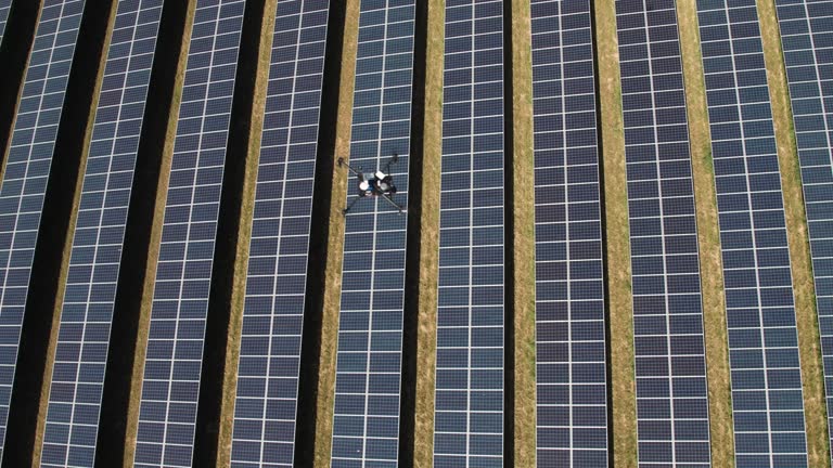
drone inspecting a solar farm - farm aerial map stock videos & royalty-free footage00:09Drone Inspecting a Solar FarmSolar Panel, Solar Equipment, Solar Energy
drone inspecting a solar farm - farm aerial map stock videos & royalty-free footage00:19Drone Inspecting a Solar FarmSolar Panel
aerial view of fields and woodland. 4k - farm aerial map stock videos & royalty-free footage00:29Aerial View of Fields and Woodland. 4K
aerial view of village in northern thailand. - farm aerial map stock videos & royalty-free footage00:13Aerial view of village in northern Thailand.
aerial view of village in northern thailand. - farm aerial map stock videos & royalty-free footage00:12Aerial view of village in northern Thailand.
aerial view of village in northern thailand. - farm aerial map stock videos & royalty-free footage00:16Aerial view of village in northern Thailand.
aerial: a rural area beneath a plane - farm aerial map stock videos & royalty-free footage00:06Aerial: A rural area beneath a plane
the strength of france; france:intcharles de gaulle speaking sot extvarious shots of de gaulle meeting public on walkabout / close up of 'le canard... - farm aerial map stock videos & royalty-free footage03:04ITN Roving Report: The Strength of FranceCharles de Gaulle
mexico of the plumed serpent; mexico: mexico city: extview of same square by day mainly empty / cars in streets surrounding square / shots of various... - farm aerial map stock videos & royalty-free footage03:00ITN Roving Report: Mexico of the Plumed SerpentMexico
following the warmest and driest april on record, moorland fires broke out across the uk. ogden moor near wainstalls above halifax was one of many victims. several square km of moorland burned for four days. the blaze was tackled by fire fighters, but desp - farm aerial map stock videos & royalty-free footage00:20Following the warmest and driest April on record, moorland fires broke out across the UK. Ogden Moor near Wainstalls above Halifax was one of many victims. Several square Km of moorland burned for four days. The blaze was tackled by fire fighters, but despPeat
following the warmest and driest april on record, moorland fires broke out across the uk. ogden moor near wainstalls above halifax was one of many victims. several square km of moorland burned for four days. the blaze was tackled by fire fighters, but desp - farm aerial map stock videos & royalty-free footage00:19Following the warmest and driest April on record, moorland fires broke out across the UK. Ogden Moor near Wainstalls above Halifax was one of many victims. Several square Km of moorland burned for four days. The blaze was tackled by fire fighters, but despCarbon Neutrality, UK, Wildfire
following the warmest and driest april on record, moorland fires broke out across the uk. ogden moor near wainstalls above halifax was one of many victims. several square km of moorland burned for four days. the blaze was tackled by fire fighters, but desp - farm aerial map stock videos & royalty-free footage00:16Following the warmest and driest April on record, moorland fires broke out across the UK. Ogden Moor near Wainstalls above Halifax was one of many victims. Several square Km of moorland burned for four days. The blaze was tackled by fire fighters, but desp
following the warmest and driest april on record, moorland fires broke out across the uk. ogden moor near wainstalls above halifax was one of many victims. several square km of moorland burned for four days. the blaze was tackled by fire fighters, but desp - farm aerial map stock videos & royalty-free footage00:19Following the warmest and driest April on record, moorland fires broke out across the UK. Ogden Moor near Wainstalls above Halifax was one of many victims. Several square Km of moorland burned for four days. The blaze was tackled by fire fighters, but desp
following the warmest and driest april on record, moorland fires broke out across the uk. ogden moor near wainstalls above halifax was one of many victims. several square km of moorland burned for four days. the blaze was tackled by fire fighters, but desp - farm aerial map stock videos & royalty-free footage00:21Following the warmest and driest April on record, moorland fires broke out across the UK. Ogden Moor near Wainstalls above Halifax was one of many victims. Several square Km of moorland burned for four days. The blaze was tackled by fire fighters, but desp
following the warmest and driest april on record, moorland fires broke out across the uk. ogden moor near wainstalls above halifax was one of many victims. several square km of moorland burned for four days. the blaze was tackled by fire fighters, but desp - farm aerial map stock videos & royalty-free footage00:14Following the warmest and driest April on record, moorland fires broke out across the UK. Ogden Moor near Wainstalls above Halifax was one of many victims. Several square Km of moorland burned for four days. The blaze was tackled by fire fighters, but despCarbon Neutrality
following the warmest and driest april on record, moorland fires broke out across the uk. ogden moor near wainstalls above halifax was one of many victims. several square km of moorland burned for four days. the blaze was tackled by fire fighters, but desp - farm aerial map stock videos & royalty-free footage00:15Following the warmest and driest April on record, moorland fires broke out across the UK. Ogden Moor near Wainstalls above Halifax was one of many victims. Several square Km of moorland burned for four days. The blaze was tackled by fire fighters, but desp
following the warmest and driest april on record, moorland fires broke out across the uk. ogden moor near wainstalls above halifax was one of many victims. several square km of moorland burned for four days. the blaze was tackled by fire fighters, but desp - farm aerial map stock videos & royalty-free footage00:24Following the warmest and driest April on record, moorland fires broke out across the UK. Ogden Moor near Wainstalls above Halifax was one of many victims. Several square Km of moorland burned for four days. The blaze was tackled by fire fighters, but desp
following the warmest and driest april on record, moorland fires broke out across the uk. ogden moor near wainstalls above halifax was one of many victims. several square km of moorland burned for four days. the blaze was tackled by fire fighters, but desp - farm aerial map stock videos & royalty-free footage00:16Following the warmest and driest April on record, moorland fires broke out across the UK. Ogden Moor near Wainstalls above Halifax was one of many victims. Several square Km of moorland burned for four days. The blaze was tackled by fire fighters, but desp
following the warmest and driest april on record, moorland fires broke out across the uk. ogden moor near wainstalls above halifax was one of many victims. several square km of moorland burned for four days. the blaze was tackled by fire fighters, but desp - farm aerial map stock videos & royalty-free footage00:15Following the warmest and driest April on record, moorland fires broke out across the UK. Ogden Moor near Wainstalls above Halifax was one of many victims. Several square Km of moorland burned for four days. The blaze was tackled by fire fighters, but despCarbon Neutrality, Fuel and Power Generation, Technology
following the warmest and driest april on record, moorland fires broke out across the uk. ogden moor near wainstalls above halifax was one of many victims. several square km of moorland burned for four days. the blaze was tackled by fire fighters, but desp - farm aerial map stock videos & royalty-free footage00:27Following the warmest and driest April on record, moorland fires broke out across the UK. Ogden Moor near Wainstalls above Halifax was one of many victims. Several square Km of moorland burned for four days. The blaze was tackled by fire fighters, but despFire - Natural Phenomenon, Moor
cu shot of detailed map of europe and british isles for air raid - farm aerial map stock videos & royalty-free footage00:31CU Shot of detailed map of Europe and British Isles for air raid
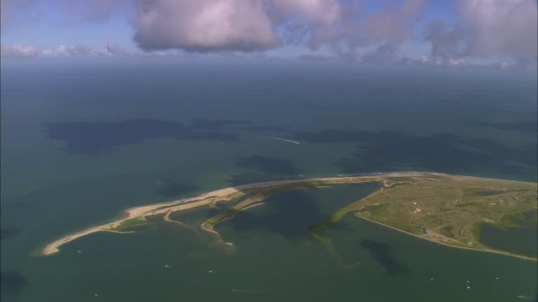
north norfolk coast near blakeney - farm aerial map stock videos & royalty-free footage00:45North Norfolk Coast Near Blakeney
aerial view town and country in sunshine. hd - farm aerial map stock videos & royalty-free footage00:27Aerial View Town and Country in Sunshine. HD
aerial view country in sunshine. hd - farm aerial map stock videos & royalty-free footage00:28Aerial View Country in Sunshine. HD
aerial view town and country in sunshine. hd - farm aerial map stock videos & royalty-free footage00:14Aerial View Town and Country in Sunshine. HD
aerial view town and country in sunshine. hd - farm aerial map stock videos & royalty-free footage00:28Aerial View Town and Country in Sunshine. HD
aerial view town and country in sunshine. hd - farm aerial map stock videos & royalty-free footage00:08Aerial View Town and Country in Sunshine. HD
aerial view vineyard in sunshine. hd - farm aerial map stock videos & royalty-free footage00:28Aerial View Vineyard in Sunshine. HD
aerial view vineyard in sunshine. hd - farm aerial map stock videos & royalty-free footage00:23Aerial View Vineyard in Sunshine. HD
aerial view town and country in sunshine. hd - farm aerial map stock videos & royalty-free footage00:29Aerial View Town and Country in Sunshine. HDUK, City
aerial view town and country in sunshine. hd - farm aerial map stock videos & royalty-free footage00:13Aerial View Town and Country in Sunshine. HD
aerial view town and country in sunshine. hd - farm aerial map stock videos & royalty-free footage00:19Aerial View Town and Country in Sunshine. HD
aerial view town and country in sunshine. hd - farm aerial map stock videos & royalty-free footage00:25Aerial View Town and Country in Sunshine. HD
aerial view town and country in sunshine. hd - farm aerial map stock videos & royalty-free footage00:22Aerial View Town and Country in Sunshine. HD
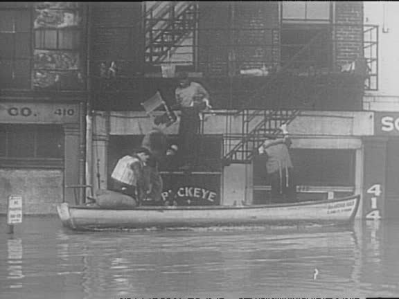
aerial ohio river floods parts of cincinnati / houses, farms, bridges, and airport underwater / flooded business district, street sign and phone line... - farm aerial map stock videos & royalty-free footage01:45Red Cross Helps Victims Of 1937 Ohio River Flood
rushing river water / map highlights midwestern states / aerials of flooded farmland / high waters rush under bridges / sandbagging crews offload... - farm aerial map stock videos & royalty-free footage00:43Devastating Floods In Kansas
aerial view town and country in sunshine. hd - farm aerial map stock videos & royalty-free footage00:19Aerial View Town and Country in Sunshine. HD
aerial view of countryside in sunshine. hd - farm aerial map stock videos & royalty-free footage00:13Aerial View of Countryside in Sunshine. HD
aerial view town and country in sunshine. hd - farm aerial map stock videos & royalty-free footage00:14Aerial View Town and Country in Sunshine. HD
aerial view of countryside in sunshine. hd - farm aerial map stock videos & royalty-free footage00:29Aerial View of Countryside in Sunshine. HD
aerial view of countryside in sunshine. hd - farm aerial map stock videos & royalty-free footage00:14Aerial View of Countryside in Sunshine. HD
aerial view of countryside in sunshine. hd - farm aerial map stock videos & royalty-free footage00:20Aerial View of Countryside in Sunshine. HD
aerial view of countryside in sunshine. hd - farm aerial map stock videos & royalty-free footage00:08Aerial View of Countryside in Sunshine. HD
aerial view of countryside in sunshine. hd - farm aerial map stock videos & royalty-free footage00:14Aerial View of Countryside in Sunshine. HD
aerial view of countryside in sunshine. hd - farm aerial map stock videos & royalty-free footage00:07Aerial View of Countryside in Sunshine. HD
aerial view of countryside in sunshine. hd - farm aerial map stock videos & royalty-free footage00:28Aerial View of Countryside in Sunshine. HD
aerial view of countryside in sunshine. hd - farm aerial map stock videos & royalty-free footage00:28Aerial View of Countryside in Sunshine. HD
aerial view of countryside in sunshine. hd - farm aerial map stock videos & royalty-free footage00:29Aerial View of Countryside in Sunshine. HD
aerial view of town in sunshine. hd - farm aerial map stock videos & royalty-free footage00:29Aerial View of Town in Sunshine. HD
aerial view town and country in sunshine. hd - farm aerial map stock videos & royalty-free footage00:27Aerial View Town and Country in Sunshine. HD
aerial view town and country in sunshine. hd - farm aerial map stock videos & royalty-free footage00:28Aerial View Town and Country in Sunshine. HD