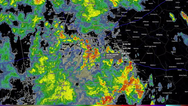
desktop computer weather radar app shows thunderstorms approaching atlanta, georgia in the early summer of 2021. - extreme weather map stock videos & royalty-free footage00:21Desktop computer weather radar app shows thunderstorms approaching Atlanta, Georgia in the early summer of 2021.Weather, Radar, Meteorology
climate change heat - extreme weather map stock videos & royalty-free footage00:57Climate change HeatClimate Change, Heat Wave, Climate
thermal abstract heat map background with glowing temperature waves – scientific interface motion for tech, energy, and medical visualizations. - extreme weather map stock videos & royalty-free footage00:10Thermal Abstract Heat Map Background with Glowing Temperature Waves – Scientific Interface Motion for Tech, Energy, and Medical Visualizations.Climate Change, Sea, Map
earth surface seen from space. northern lights and hurricane. nasa public domain imagery - extreme weather map stock videos & royalty-free footage00:10Earth surface seen from space. Northern lights and hurricane. NASA Public Domain ImageryStratosphere, Globe - Navigational Equipment, Outer Space
planet earth - extreme weather map stock videos & royalty-free footage00:20Planet EarthGlobe - Navigational Equipment, Dirt, Change
desktop computer weather radar shows severe thunderstorm warnings in the middle of america on april 08th, 2020 - extreme weather map stock videos & royalty-free footage00:19Desktop computer weather radar shows severe thunderstorm warnings in the Middle of America on April 08th, 2020Radar, Weather, Thunderstorm
desktop computer weather radar shows severe thunderstorm warnings in the middle of america on april 08th, 2020 - extreme weather map stock videos & royalty-free footage00:19Desktop computer weather radar shows severe thunderstorm warnings in the Middle of America on April 08th, 2020Radar, Weather, Thunderstorm
two weather radars on the path stopped working. desktop computer weather radar app shows the hurricane laura moving north the second day after landed in america on the august 26, 2020. - extreme weather map stock videos & royalty-free footage00:16Two weather radars on the path stopped working. Desktop computer weather radar app shows the hurricane Laura moving north the second day after landed in America on the August 26, 2020.Radar, Hurricane - Storm, Weather
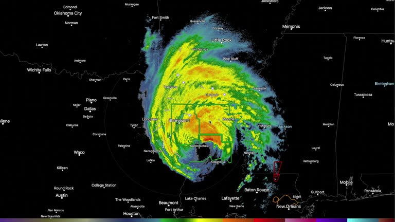
desktop computer weather radar app shows the hurricane laura moving north the second day after landed in america on the august 26, 2020. - extreme weather map stock videos & royalty-free footage00:16Desktop computer weather radar app shows the hurricane Laura moving north the second day after landed in America on the August 26, 2020.Hurricane - Storm, Radar, Danger
4k africa map links 4k with full background details - extreme weather map stock videos & royalty-free footage00:204K Africa Map Links 4K with full background detailsAfrica, Map, African Culture
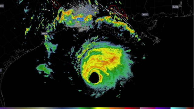
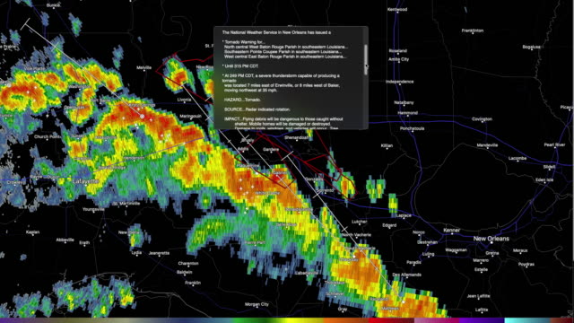
desktop computer weather radar app shows the hurricane laura invading america on the august 26, 2020, and caused tornado warnings in louisiana - extreme weather map stock videos & royalty-free footage00:12Desktop computer weather radar app shows the hurricane Laura invading America on the August 26, 2020, and caused tornado warnings in LouisianaHurricane - Storm, Meteorology, Weather
earth after 70-metre sea level rise - extreme weather map stock videos & royalty-free footage00:32Earth after 70-metre sea level riseGlobe - Navigational Equipment, Map, Antarctica
earth after 70-metre sea level rise - extreme weather map stock videos & royalty-free footage00:24Earth after 70-metre sea level riseGlobe - Navigational Equipment, Antarctica, Greenland
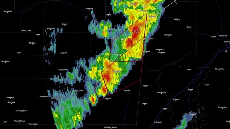
desktop computer weather radar app shows thunderstorms and tornado warning in jackson, mississippi - extreme weather map stock videos & royalty-free footage00:34Desktop Computer Weather Radar App Shows Thunderstorms And Tornado Warning In Jackson, MississippiRadar, Map, Motion
rare and dangerous heat wave has spread across the eastern united states, placing more than 160 million people under heat alerts as major cities... - extreme weather map stock videos & royalty-free footage00:21MOTION GRAPHIC - Extreme heat wave grips eastern US with record-breaking temperaturesMap, USA, Chicago - Illinois
looping ice globe - extreme weather map stock videos & royalty-free footage00:16Looping Ice GlobeGlobe - Navigational Equipment, White Color, Winter
weather radar shows tornado warning in the southeast of america - extreme weather map stock videos & royalty-free footage00:16Weather radar shows tornado warning in the southeast of AmericaWeather, Data, Meteorology
4k resolution dust particles abstract background of globe form for business science or technology , futuristic earth globe - extreme weather map stock videos & royalty-free footage00:304k resolution Dust Particles Abstract Background of globe form for business science or technology , Futuristic earth globeGlobe - Navigational Equipment, Digitally Generated Image, Global
of the heatwave in europe, showing daily temperature forecasts from monday, june 30 to saturday, july 5 at 1500 gmt - extreme weather map stock videos & royalty-free footage00:20CLEAN : ANIMATED MAP: Heatwave in EuropeEurope, Heat Wave, Map
severe weather is expected to impact large portions of the united states this week, with violent thunderstorms forecast to sweep across the... - extreme weather map stock videos & royalty-free footage00:14MOTION GRAPHIC - Severe storms to slam large parts of U.S.; tornadoes, hail and flooding possibleTornado, Map
close-up of an engineer drawing a plan after a flood on the missouri river, north kansas city, mo, us, 1952. the floods of april 1952 in the milk... - extreme weather map stock videos & royalty-free footage00:30Close-up of an engineer drawing a plan after a flood on the Missouri River, North Kansas City, MO, USMap, Only Men, Office
map showing the locations of sierra leone and freetown, where a mudslide has killed more than 200 people. - extreme weather map stock videos & royalty-free footage00:08Mudslides in Sierra Leone kill more than 200 - MapMap, Sierra Leone, Mudslide
computer simulation of hurricane katrina forming off coast of america - extreme weather map stock videos & royalty-free footage00:07Computer simulation of Hurricane Katrina forming off coast of AmericaHurricane Katrina, Map
4k resolution dust particles abstract background of world map for business science or technology, futuristic earth globe - extreme weather map stock videos & royalty-free footage00:204k resolution Dust Particles Abstract Background of World map for business science or technology, Futuristic earth globe
has played an important role in giving information about the meteorological phenomenon that has pounded the u.s.a. elements of this image furnished... - extreme weather map stock videos & royalty-free footage01:36United States: Weather Map of Hurricane Harvey, point of view from spaceHurricane - Storm, Meteorology, Map
water flowing from lake tana into blue nile & up to british sudan toward nile river. - extreme weather map stock videos & royalty-free footage00:12Animated map of EthiopiaSudan, Ethiopia, Africa
cape san blas lighthouse - port st. joe, florida - extreme weather map stock videos & royalty-free footage00:37Cape San Blas Lighthouse - Port St. Joe, FloridaHurricane - Storm, Gulf Coast States
hurricane erin swept through the east coast, bringing heavy rain and strong winds.local authorities in north carolina ordered a mandatory evacuation... - extreme weather map stock videos & royalty-free footage00:23MOTION GRAPHIC - Hurricane Erin batters East Coast with heavy rain and strong windsHurricane - Storm, Map, USA
sleepy driver reflected in rearview mirror during road trip - extreme weather map stock videos & royalty-free footage00:13Sleepy Driver Reflected in Rearview Mirror During Road TripDriving, Fog, Car
hurricane helene made landfall on the coast of florida on friday, september 27, as a category 4 storm, resulting in the deaths of three individuals,... - extreme weather map stock videos & royalty-free footage00:22MOTIONGRAPHIC - Hurricane Helene hits Florida as category 4, causing fatalities2024 Hurricane Helene, Hurricane - Storm, Map
motion graphic titled "cyclone michaung set to hit indian coasts" was created in ankara, türkiye on december 04, 2023. the deep depression over the... - extreme weather map stock videos & royalty-free footage00:20Cyclone Michaung set to hit Indian coastsMap, Cyclone, Weather
engineers in the office reviewing plans and discussing the effects of flooding on the missouri river, north kansas city, mo, us, 1952. the floods of... - extreme weather map stock videos & royalty-free footage00:35Engineers in the office reviewing plans and discussing the effects of flooding on the Missouri River, North Kansas City, MO, USMap
freezing earth - extreme weather map stock videos & royalty-free footage00:12freezing earthGlobe - Navigational Equipment, Ice Age, Ice
global warming, climate change, death of the earth - extreme weather map stock videos & royalty-free footage00:21Global Warming, Climate Change, Death of the EarthMap, Weather, Globe - Navigational Equipment
desktop computer weather radar app shows the hurricane laura invading america on the august 26, 2020, and caused tornado warnings in louisiana - extreme weather map stock videos & royalty-free footage00:29Desktop computer weather radar app shows the hurricane Laura invading America on the August 26, 2020, and caused tornado warnings in LouisianaWeather, Meteorology, Radar
desktop computer weather radar app shows rain developing in the southeast of america - extreme weather map stock videos & royalty-free footage00:12Desktop computer weather radar app shows rain developing in the southeast of AmericaRadar, Doppler, Weather
world regions affected by climate change. the concept of computer virus, spread virus animation - extreme weather map stock videos & royalty-free footage00:11World regions affected by climate change. The concept of Computer virus, Spread virus animationMap, Globe - Navigational Equipment
animating map showing the location of the strategic russian-held kakhovka hydroelectric dam, with kyiv and moscow blaming each other for damage to... - extreme weather map stock videos & royalty-free footage00:24CLEAN : Animated map: the damaged Russian-controlled Kakhovka dam in UkraineUkraine, Map
4k resolution world map movement for business science or technology, futuristic earth globe - extreme weather map stock videos & royalty-free footage00:204k resolution world map movement for business science or technology, Futuristic earth globeGlobal
wetlands destruction; usa: louisiana: south of new orleans:int plane/ mid airview of wetlands of mississippi delta extair view mississippi delta... - extreme weather map stock videos & royalty-free footage06:50New Orleans: wetlands destructionHurricane Katrina, Louisiana, Map
heavy rain brought flash flooding to parts of the new orleans metro area on monday, april 21, according to the... - extreme weather map stock videos & royalty-free footage01:41Heavy Rain Brings Flooding to New OrleansLouisiana, Flood, Map
sleepy driver reflected in rearview mirror during road trip - extreme weather map stock videos & royalty-free footage00:12Sleepy Driver Reflected in Rearview Mirror During Road TripDriving, Rear-View Mirror, Flood
desktop computer weather radar app shows thunderstorms and tornado warning in jackson, mississippi - extreme weather map stock videos & royalty-free footage00:41Desktop Computer Weather Radar App Shows Thunderstorms And Tornado Warning In Jackson, MississippiRadar, Doppler, Storm
desktop computer weather radar app shows thunderstorms and tornado warning in brookhaven, mississippi - extreme weather map stock videos & royalty-free footage00:43Desktop Computer Weather Radar App Shows Thunderstorms And Tornado Warning In Brookhaven, MississippiClimate Change, Computer Graphic, USA
desktop computer weather radar app shows thunderstorms and tornado warning in franklin, louisiana - extreme weather map stock videos & royalty-free footage00:40Desktop Computer Weather Radar App Shows Thunderstorms And Tornado Warning In Franklin, LouisianaRadar, Storm, Extreme Weather
4k portugal map links 4k with full background details - extreme weather map stock videos & royalty-free footage00:194K Portugal Map Links 4K with full background detailsFlood, Chili Con Carne
two people were killed after record-breaking rainfall triggered extensive https://x.com/nwsalbuquerque/status/1847888644977336705 flash flooding in... - extreme weather map stock videos & royalty-free footage02:57Deadly Flooding Leaves Trail of Destruction in New MexicoNew Mexico, Map
tourists visiting negril, jamaica, were thrilled to witness a waterspout forming off the coast of the island recently. pat aleywine captured this... - extreme weather map stock videos & royalty-free footage01:16Tourists Thrilled to Witness 'Monster' Waterspout Forming in JamaicaJamaica, Map
at least 42 people were killed when a dam burst north of the kenyan capital nairobi, the governor of the local county told afp - extreme weather map stock videos & royalty-free footage00:24CLEAN : MAP: Dozens dead after Kenyan dam bursts banksNairobi, Flood
a cgi map of the netherlands shows the impact of rising sea levels. available in hd. - extreme weather map stock videos & royalty-free footage00:12A CGI map of the Netherlands shows the impact of rising sea levels. Available in HD.Netherlands, Rising Sea Level, Flood
what makes the wind blow? - part 23 of 27. possible explanations for the cause of a typical onshore breeze are tried out in the laboratory and double-checked in nature. pressure differences are found to be associated with normal daytime air movements. exp - extreme weather map stock videos & royalty-free footage00:37What Makes the Wind Blow? - part 23 of 27. Possible explanations for the cause of a typical onshore breeze are tried out in the laboratory and double-checked in nature. Pressure differences are found to be associated with normal daytime air movements. ExpMap
aerial shot of a river surrounded by mountains and forests in thailand, asia - extreme weather map stock videos & royalty-free footage00:10Aerial shot of A river surrounded by mountains and forests in Thailand, AsiaAmazon River, Map
climate change - 4k resolution - extreme weather map stock videos & royalty-free footage00:30Climate Change - 4K ResolutionWater, Water Conservation, Globe - Navigational Equipment
dry soil and drought - extreme weather map stock videos & royalty-free footage00:15Dry soil and droughtCracked, Dirt, Land
dry soil and drought - extreme weather map stock videos & royalty-free footage00:20Dry soil and droughtDrought, Dirt, Land
[fort myer, va] a graphic map showing flood path from pennsylvania to louisiana and a pointer shows the effected area / a radio tower over "signal... - extreme weather map stock videos & royalty-free footage01:00US Army Signal Corps at Ft. Myer, VA, and flooding in Evansville, INFlood, Ohio River
map ohio river states and cities with pointer on louisville / flooded street / boat with refugees and belongings, store in bg / men unload from truck... - extreme weather map stock videos & royalty-free footage00:52Flooded city streets in the OH River Valley; building sandbag levee
frejus; france: frejus:close shots of flowers / sign for 'frejus' / quiet street / reporter to cameradecember 1959aerials broken malpasset dam,... - extreme weather map stock videos & royalty-free footage03:11ITN Roving Report: FrejusDam, France, Train - Vehicle
intbob ward at work in insurance office and demonstrating map of expected effect of hurricane gustav over new orleans levees - extreme weather map stock videos & royalty-free footage00:58Hurricane Gustav hits land
70-metre sea level rise earth - extreme weather map stock videos & royalty-free footage00:2470-metre sea level rise EarthClimate Change, Planet - Space, Melting
cape san blas lighthouse - port st. joe, florida - extreme weather map stock videos & royalty-free footage00:16Cape San Blas Lighthouse - Port St. Joe, FloridaGulf of Mexico
cape san blas lighthouse - port st. joe, florida - extreme weather map stock videos & royalty-free footage00:35Cape San Blas Lighthouse - Port St. Joe, FloridaGulf of Mexico
roommates helped an elderly man after he entered deep floodwaters in southern california and his car floated before their eyes on friday night,... - extreme weather map stock videos & royalty-free footage03:41Roommates Rescue Vietnam War Vet Trapped in Floodwaters
funnel cloud was seen churning in the distance from lingo, new mexico, on thursday, june 5, as a tornado... - extreme weather map stock videos & royalty-free footage00:49Gusty Conditions as Funnel Cloud Churns in the DistanceUSA, Extreme Weather
map showing mokwa, where torrential rains devastated the central nigerian city and killed dozens of people, emergency services said amid a search for... - extreme weather map stock videos & royalty-free footage00:24CLEAN : MAP: Dozens killed in flash floods in Northern NigeriaRain, Map, Flood
destructive storms moved through central texas on the evening of wednesday, may 28, bringing damaging wind gusts, hail, and flooding, the... - extreme weather map stock videos & royalty-free footage00:25Stunning Aerial Footage Shows Severe Thunderstorm Approaching AustinTexas, Map
sailboat braving rough seas: a thrilling ocean adventure - extreme weather map stock videos & royalty-free footage00:05Sailboat Braving Rough Seas: A Thrilling Ocean AdventureUSA
aerial view to the monegros desert or desierto de los monegros is a semi-desert in aragón, northeastern spain - extreme weather map stock videos & royalty-free footage00:12Aerial view to the Monegros Desert or Desierto de los Monegros is a semi-desert in Aragón, northeastern SpainMap
the french island territory of mayotte was devastated on sunday, december 15, a day after cyclone chido ripped across the region, leaving at least a... - extreme weather map stock videos & royalty-free footage13:06Cyclone Chido Leaves Deadly Path of Destruction Across MayotteMayotte, Accidents and Disasters, Map
drone footage showed the extensive flooding in saint-palais, france, on october 17, as meteo france had weather warnings in place for the town and... - extreme weather map stock videos & royalty-free footage07:13Drone Footage Shows Impact of Flooding in Southern French Town
floodwaters inundated parts of eastern spain on the evening of tuesday, october 29, following a destructive storm system that left at least 158... - extreme weather map stock videos & royalty-free footage00:18Floodwaters Bring Devastation to Eastern Spain Following Torrential RainComunidad Autonoma de Valencia, Valencia - Spain, Map
at least 18 people were killed and 40 others were missing after catastrophic flooding and landslides hit parts of bosnia october 3 and 4, according... - extreme weather map stock videos & royalty-free footage01:36Deadly Flooding and Landslides Hit Bosnia After Heavy Rain Drenches Region
severe flooding was seen in parts of atlanta, georgia, in the early morning hours of friday, september 27, as hurricane helene made landfall in... - extreme weather map stock videos & royalty-free footage01:21Person Floats on Air Mattress as Water Rescues Carried Out at Atlanta Apartment Complex2024 Hurricane Helene, Flood
woman in valley view, texas, captured video of debris swirling around her car as a deadly ef-2... - extreme weather map stock videos & royalty-free footage03:23'We're in It!': Debris Swirls Around Car as Deadly Tornado Strikes North TexasMap
earth 360 or planet in space material earth cloud from nasa. - extreme weather map stock videos & royalty-free footage00:30Earth 360 or Planet in Space material earth cloud from NASA.Globe - Navigational Equipment, Planet - Space, Spinning
global 360 degree in esg clean energy reduce temperature material earth cloud from nasa - extreme weather map stock videos & royalty-free footage00:30Global 360 degree in ESG clean energy reduce temperature material earth cloud from NASAGlobe - Navigational Equipment, Spinning, Planet - Space
global warming concept with thermometer and earth - extreme weather map stock videos & royalty-free footage00:18Global warming concept with thermometer and earthIndia, Weather, Heat Wave
earth science: exploring planet earth - part 28 of 35. earth science embraces broad areas of study. since ancient times, humans have tried to discover the secrets of earth. we have studied the motions of celestial bodies, made observations on volcanic act - extreme weather map stock videos & royalty-free footage00:30Earth Science: Exploring Planet Earth - part 28 of 35. Earth science embraces broad areas of study. Since ancient times, humans have tried to discover the secrets of Earth. We have studied the motions of celestial bodies, made observations on volcanic actArchival, Map, Tornado
aerial view of island like a map of thailand in reservoir, trang province, thailand - extreme weather map stock videos & royalty-free footage00:14Aerial view of Island like a map of Thailand in reservoir, Trang Province, ThailandMap
4k africa map links 4k with full background details - extreme weather map stock videos & royalty-free footage00:204K Africa Map Links 4K with full background detailsAfrica