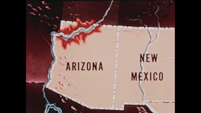
southwestern states (2nd edition) - part 2 of 19. traces population trends and explains geographical features by means of animated maps. illustrates such occupational activities as irrigation, stock raising, agriculture, mining, and oil extracting and ref - colorado river map stock videos & royalty-free footage00:30Southwestern States (2nd edition) - part 2 of 19. Traces population trends and explains geographical features by means of animated maps. Illustrates such occupational activities as irrigation, stock raising, agriculture, mining, and oil extracting and refMap, Archival, Old-fashioned
map of colorado united states america usa, 3d animation - colorado river map stock videos & royalty-free footage00:10Map of COLORADO United States America USA, 3D AnimationColorado River, Map, Colorado
"begin boulder dam! las vegas, nev. - site of gigantic power project, named for president hoover, is visited by sec'y of interior wilbur" / crowd... - colorado river map stock videos & royalty-free footage01:33Dedication of site of construction of Hoover Dam in NevadaHoover Dam, Colorado River, Construction Site
map; pointer indicates route reaching to the pacific ocean from the colorado river as southern california's 390-mile aqueduct nears completion / tilt... - colorado river map stock videos & royalty-free footage01:41390 mile aqueduct is near completion with the removal of the final barrier in Coachella tunnelColorado River, Aqueduct, California
photographer captured an idyllic scene near aspen, colorado, on sunday, july 13, as a bull moose was seen cooling off in maroon lake. this footage... - colorado river map stock videos & royalty-free footage00:34Idyllic Scene as Moose Cools Off in Mountain LakeColorado River, Moose
helicopter crews were seen dropping fire retardant over burning vegetation as a wildfire spread near carbondale, colorado, on sunday, august 3.... - colorado river map stock videos & royalty-free footage01:04Aerial Crews Work to Contain Spread of Colorado WildfireColorado River, Fire - Natural Phenomenon, Colorado
"dig canal through us sahara," / pan desert of imperial valley / vs bulldozer moving across sand / map of valley with pointer showing proposed canal,... - colorado river map stock videos & royalty-free footage00:37Bulldozer through Imperial Valley sand dunes; map of proposed All-American CanalAqueduct, Colorado River, California
the oregon trail - part 1 of 44. dramatizes the experiences of a family migrating to oregon in a wagon train. stresses the hardships of the journey; the long treks under the prairie sun, the dangerous river crossing, the threat of an indian attack, and th - colorado river map stock videos & royalty-free footage00:35The Oregon Trail - part 1 of 44. Dramatizes the experiences of a family migrating to Oregon in a wagon train. Stresses the hardships of the journey; the long treks under the prairie sun, the dangerous river crossing, the threat of an Indian attack, and thBlack And White, Colorado River
"world record water tunnel put through." / map; pointer indicates route reaching to the pacific ocean from the colorado river as southern... - colorado river map stock videos & royalty-free footage01:31390-mile aqueduct is near completion with the removal of the final barrier in the Coachella tunnelGreat Depression
man pov rafting with kayak in river: checking the map on mobile phone - colorado river map stock videos & royalty-free footage00:39Man POV rafting with kayak in river: checking the map on mobile phoneKayak, Mobile Phone, Rafting
dozens of pumpkins have once again appeared https://www.aspentimes.com/news/mysterious-pumpkins-keep-on-appearing-in-fryingpan-valley/ along frying... - colorado river map stock videos & royalty-free footage01:06Dozens of Pumpkins Appear Along Road in Colorado
drone footage captured vibrant autumn colors at sunrise in central colorado on saturday, october 12. this footage shows the roaring fork river near... - colorado river map stock videos & royalty-free footage00:31Sun Rises on Golden Colorado FoliageDrone Point of View
the colorado department of transportation was https://www.facebook.com/coloradodot/posts/904113968426456 forced to close highway 82 south of glenwood... - colorado river map stock videos & royalty-free footage00:39Drone Footage Shows Mudslide That Closed Colorado Highway
map of colorado united states america usa, 3d animation - colorado river map stock videos & royalty-free footage00:17Map of COLORADO United States America USA, 3D Animation
southwestern states (2nd edition) - part 3 of 19. traces population trends and explains geographical features by means of animated maps. illustrates such occupational activities as irrigation, stock raising, agriculture, mining, and oil extracting and ref - colorado river map stock videos & royalty-free footage00:30Southwestern States (2nd edition) - part 3 of 19. Traces population trends and explains geographical features by means of animated maps. Illustrates such occupational activities as irrigation, stock raising, agriculture, mining, and oil extracting and refMap, 1950-1959
pan mountains with a little bit of snow on them / small town with blue river flowing through it, mountains in bkgd / tall pine trees, rock... - colorado river map stock videos & royalty-free footage00:38Thirteen hundred square miles of Colorado territory become part of US in 1936Mergers and Acquisitions, USA
usa, state of colorado - colorado river map stock videos & royalty-free footage00:15USA, State of Colorado
usa, state of colorado - colorado river map stock videos & royalty-free footage00:06USA, State of Colorado
usa, state of colorado - colorado river map stock videos & royalty-free footage00:08USA, State of Colorado
usa, state of colorado - colorado river map stock videos & royalty-free footage00:07USA, State of Colorado
usa, state of colorado - colorado river map stock videos & royalty-free footage00:07USA, State of Colorado
usa, state of colorado - colorado river map stock videos & royalty-free footage00:08USA, State of Colorado
men panning for gold in river in colorado / mountains in rocky mountains / river running through canyon / two shots of men using shovels to dig for... - colorado river map stock videos & royalty-free footage01:45Mining engineer speaking in NY City during Great Depression recommends that unemployed men pan for gold in Western USUSA, Panning for Gold, Mining - Natural Resources