night flight from new york to orbit the earth. loopable. - aerial city map stock videos & royalty-free footage00:30Night flight from New York to orbit the Earth. Loopable.Globe - Navigational Equipment, Night, World Map
night flight from new york to orbit the earth. loopable. - aerial city map stock videos & royalty-free footage00:46Night flight from New York to orbit the Earth. Loopable.City, Satellite View, Globe - Navigational Equipment
top view, flying over idyllic villa area and farm - aerial city map stock videos & royalty-free footage00:27Top view, flying over idyllic villa area and farmSuburb
highly detailed world map - night, global business - north and south america, europe, africa, asia - aerial city map stock videos & royalty-free footage00:30Highly Detailed World Map - Night, Global Business - North And South America, Europe, Africa, AsiaGlobe - Navigational Equipment, Africa, Sea
power blackout - aerial city map stock videos & royalty-free footage00:08Power blackoutBlackout, City, Illuminated
plane 02 - aerial city map stock videos & royalty-free footage00:07plane 02Airplane, Aerospace Industry, Technology
aerial view of village at night - aerial city map stock videos & royalty-free footage00:11Aerial view of village at nightNight, Residential District, Aerial View
zoom in on monochrome map of gaza strip, 4k, high quality, dark theme, simple world map, monochrome style, night, highlighted country and cities, satellite and aerial view of provinces, state, city, - aerial city map stock videos & royalty-free footage00:12Zoom in on monochrome map of Gaza Strip, 4K, high quality, dark theme, simple world map, monochrome style, night, highlighted country and cities, satellite and aerial view of provinces, state, city,Gaza Strip, Map, War
abstract cityscape - aerial city map stock videos & royalty-free footage00:16Abstract cityscapeBackgrounds, City Map, Warehouse
aerial view of village at night - aerial city map stock videos & royalty-free footage00:17Aerial view of village at nightNight, Suburb, Drone
road trip during winter time in japan - aerial city map stock videos & royalty-free footage00:13Road trip during winter time in JapanHokkaido, Japan, Winter
zoom in to manhattan, new york city from earth. satellite view of the united states of america. cinematic world map animation from outer space to territories. the concept of usa, nyc highlight, globe, aerial view, tourism, travel, journey, cityscape - aerial city map stock videos & royalty-free footage00:16Zoom in to Manhattan, New York City from Earth. Satellite view of the United States of America. Cinematic world map animation from outer space to territories. The concept of USA, NYC highlight, globe, aerial view, tourism, travel, journey, cityscapeNew York City, Map, Globe - Navigational Equipment
power blackout - aerial city map stock videos & royalty-free footage00:07Power blackoutBlackout, City, Grid Pattern
timelapse of residential district or village in top view - aerial city map stock videos & royalty-free footage00:04Timelapse of Residential district or village in top viewSmall, Village, Aerial View
highly detailed world map - blue, global business - north and south america, europe, africa, asia - aerial city map stock videos & royalty-free footage00:30Highly Detailed World Map - Blue, Global Business - North And South America, Europe, Africa, AsiaSea, Africa, Map
"let's all vote!" / high overhead shot of countryside / herd of sheep / countryside, tree in foreground / shot across water of new york city skyline... - aerial city map stock videos & royalty-free footage02:51A reminder for all to vote in 1952 US presidential election with various scenes of life in US1950-1959, Map, Washington DC
satellite internet and 5g network. loopable. - aerial city map stock videos & royalty-free footage00:37Satellite Internet and 5G network. Loopable.Satellite, Satellite View, Connection
zoom in to chiba, japan from earth. satellite view of the east asia. cinematic world map animation from outer space to territories. the concept of highlight the province, globe, tourism, travel, journey, aerial view of country, - aerial city map stock videos & royalty-free footage00:16Zoom in to Chiba, Japan from Earth. Satellite view of the East Asia. Cinematic world map animation from outer space to territories. The concept of highlight the province, globe, tourism, travel, journey, aerial view of country,Globe - Navigational Equipment, Japan, Outer Space
highly detailed world map - global business - north and south america, europe, africa, asia - aerial city map stock videos & royalty-free footage00:30Highly Detailed World Map - Global Business - North And South America, Europe, Africa, AsiaGlobe - Navigational Equipment, Satellite View, Aerial View
map of algeria, morocco, casablanca / aerial shot of casablanca and its harbors, warships / back to map / shot of oran, algeria, its harbor, warships... - aerial city map stock videos & royalty-free footage02:03Allied Forces, Casablanca, Oran, Tunis, and TripoliMorocco, Algeria, Map
zoom in to kawasaki (kanji: 川崎), japan from earth. satellite view of the east asia. cinematic world map animation from outer space to territories. the concept of highlight the province, globe, tourism, travel, journey, aerial view of country - aerial city map stock videos & royalty-free footage00:16Zoom in to Kawasaki (Kanji: 川崎), Japan from Earth. Satellite view of the East Asia. Cinematic world map animation from outer space to territories. The concept of highlight the province, globe, tourism, travel, journey, aerial view of countryAerial View, Kawasaki - Kanagawa Prefecture
aerial view of a seaside town - aerial city map stock videos & royalty-free footage00:26Aerial view of a seaside townAerial View
aerial view of budapest cityscape at sunrise - aerial city map stock videos & royalty-free footage00:21Aerial view of Budapest cityscape at sunriseHungary, Budapest, Aerial View
map of senegal highlighting dakar / various aerial shots of dakar / vs vichy france official looking out of window of building / two vichy france... - aerial city map stock videos & royalty-free footage00:46During World War II, Vichy France military in port city of Dakar, French West Africa (later Senegal)Dakar, Vichy, Aerial View
aerial view of residential houses - aerial city map stock videos & royalty-free footage00:09Aerial view of residential housesAerial View, Above, House
telecommunications of the planet. loopable. - aerial city map stock videos & royalty-free footage00:46Telecommunications of the planet. Loopable.Connection, Globe - Navigational Equipment, Map
top view and zoom out of residential district or village in day time - aerial city map stock videos & royalty-free footage00:30Top view and zoom out of Residential district or village in day timeZoom Out, Cityscape, Car
cityscape timelapse - aerial city map stock videos & royalty-free footage00:12Cityscape timelapseWhite Color, Aerial View, Computer Graphic
aerial shot of japan landscape in winter season.road trip in japan - aerial city map stock videos & royalty-free footage00:13Aerial shot of Japan landscape in winter season.Road trip in JapanHokkaido, Road, Aerial View
zoom in to manhattan, new york city from earth. satellite view of the united states of america. cinematic world map animation from outer space to territories. the concept of usa, nyc highlight, globe, aerial view, tourism, travel, journey, cityscape - aerial city map stock videos & royalty-free footage00:16Zoom in to Manhattan, New York City from Earth. Satellite view of the United States of America. Cinematic world map animation from outer space to territories. The concept of USA, NYC highlight, globe, aerial view, tourism, travel, journey, cityscapeNew York City, Manhattan - New York City, Globe - Navigational Equipment
cityscape - aerial city map stock videos & royalty-free footage00:12CityscapeBuilt Structure, Computer Graphic, Digitally Generated Image
europe at night - city lights and transportation routes - global business, economy, supply chain - aerial city map stock videos & royalty-free footage00:12Europe At Night - City Lights And Transportation Routes - Global Business, Economy, Supply ChainEurope, Map, Globe - Navigational Equipment
zoom in on monochrome map of india, 4k, high quality, dark theme, simple world map, monochrome style, night, highlighted country and cities, satellite and aerial view of provinces, state, city, - aerial city map stock videos & royalty-free footage00:12Zoom in on monochrome map of India, 4K, high quality, dark theme, simple world map, monochrome style, night, highlighted country and cities, satellite and aerial view of provinces, state, city,Map, India, Old
zoom in on monochrome map of pakistan, 4k, high quality, dark theme, simple world map, monochrome style, night, highlighted country and cities, satellite and aerial view of provinces, state, city, - aerial city map stock videos & royalty-free footage00:12Zoom in on monochrome map of Pakistan, 4K, high quality, dark theme, simple world map, monochrome style, night, highlighted country and cities, satellite and aerial view of provinces, state, city,Pakistan, Aerial View, Geographical Border
zoom in on monochrome map of congo, 4k, high quality, dark theme, simple world map, monochrome style, night, highlighted country and cities, satellite and aerial view of provinces, state, city, - aerial city map stock videos & royalty-free footage00:12Zoom in on monochrome map of Congo, 4K, high quality, dark theme, simple world map, monochrome style, night, highlighted country and cities, satellite and aerial view of provinces, state, city,Aerial View
zoom in on monochrome map of democratic republic of congo, 4k, high quality, dark theme, simple world map, monochrome style, night, highlighted country and cities, satellite and aerial view of provinces, state, city, - aerial city map stock videos & royalty-free footage00:12Zoom in on monochrome map of Democratic Republic of Congo, 4K, high quality, dark theme, simple world map, monochrome style, night, highlighted country and cities, satellite and aerial view of provinces, state, city,Democratic Republic of the Congo, World Map, Map
"egypt and iran - focus on crisis in near east" / pyramids in egypt / sphinx in egypt / map of egypt and surrounding countries / overhead shot of... - aerial city map stock videos & royalty-free footage01:34Anti-British demonstrations in Egypt, and Iran's Premier Mohammed Mossadegh speaking at UN Security Council meeting in NY CityNew York City, 1950-1959, Egypt
aerial view of village at night - aerial city map stock videos & royalty-free footage00:10Aerial view of village at nightNight, Drone, Bangkok
zoom in to yokohama (kanji: 横浜), japan from earth. satellite view of the east asia. cinematic world map animation from outer space to territories. the concept of highlight the province, globe, tourism, travel, journey, aerial view of country - aerial city map stock videos & royalty-free footage00:16Zoom in to Yokohama (Kanji: 横浜), Japan from Earth. Satellite view of the East Asia. Cinematic world map animation from outer space to territories. The concept of highlight the province, globe, tourism, travel, journey, aerial view of countryYokohama, Aerial View
zoom in to nagoya (kanji: 名古屋), japan from earth. satellite view of the east asia. cinematic world map animation from outer space to territories. the concept of highlight the province, globe, tourism, travel, journey, aerial view of country - aerial city map stock videos & royalty-free footage00:16Zoom in to Nagoya (Kanji: 名古屋), Japan from Earth. Satellite view of the East Asia. Cinematic world map animation from outer space to territories. The concept of highlight the province, globe, tourism, travel, journey, aerial view of country
zoom in to nagoya (kanji: 名古屋), japan from earth. satellite view of the east asia. cinematic world map animation from outer space to territories. the concept of highlight the province, globe, tourism, travel, journey, aerial view of country - aerial city map stock videos & royalty-free footage00:16Zoom in to Nagoya (Kanji: 名古屋), Japan from Earth. Satellite view of the East Asia. Cinematic world map animation from outer space to territories. The concept of highlight the province, globe, tourism, travel, journey, aerial view of country
zoom in to kobe (kanji: 神戸), japan from earth. satellite view of the east asia. cinematic world map animation from outer space to territories. the concept of highlight the province, globe, tourism, travel, journey, aerial view of country - aerial city map stock videos & royalty-free footage00:16Zoom in to Kobe (Kanji: 神戸), Japan from Earth. Satellite view of the East Asia. Cinematic world map animation from outer space to territories. The concept of highlight the province, globe, tourism, travel, journey, aerial view of countryMap, Kobe - Japan, Aerial View
dali old city, yunnan province, china from aerial view - aerial city map stock videos & royalty-free footage00:08Dali Old City, Yunnan Province, China from aerial viewCity Map, Rural Scene
zoom in to nagano, japan from earth. satellite view of the east asia. cinematic world map animation from outer space to territories. the concept of highlight the province, globe, tourism, travel, journey, aerial view of country, - aerial city map stock videos & royalty-free footage00:16Zoom in to Nagano, Japan from Earth. Satellite view of the East Asia. Cinematic world map animation from outer space to territories. The concept of highlight the province, globe, tourism, travel, journey, aerial view of country,Globe - Navigational Equipment, Japan, World Map
aerial shot of ski resort in japan.winter sport - aerial city map stock videos & royalty-free footage00:10Aerial shot of ski resort in Japan.winter sportJapan, Hokkaido, Ski Resort
aerial shot of ski resort in japan.winter sport - aerial city map stock videos & royalty-free footage00:11Aerial shot of ski resort in Japan.winter sportJapan, Aerial View, Skiing
cityscape timelapse - aerial city map stock videos & royalty-free footage00:12Cityscape timelapse3D Animation, Three Dimensional, City Map
abstract cityscape - aerial city map stock videos & royalty-free footage00:16Abstract cityscapeThree Dimensional, 3D Animation, City
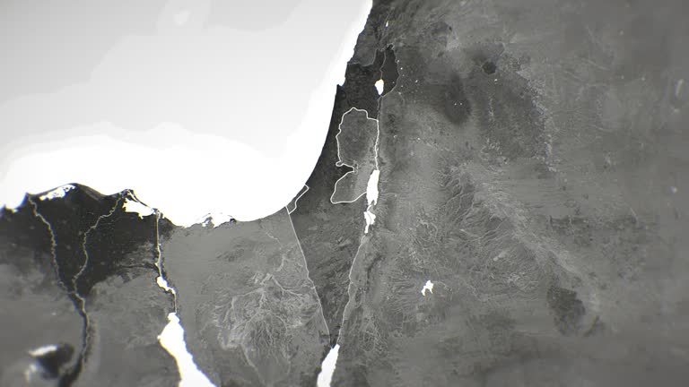
zoom in on monochrome map of palestine - israel, 4k, high quality, dark theme, simple world map, monochrome style, night, highlighted country and cities, satellite and aerial view of provinces, state, city, - aerial city map stock videos & royalty-free footage00:12Zoom in on monochrome map of Palestine - Israel, 4K, high quality, dark theme, simple world map, monochrome style, night, highlighted country and cities, satellite and aerial view of provinces, state, city,Palestine, Map, Gaza Strip
aerial view izmir - aerial city map stock videos & royalty-free footage00:10aerial view izmirAerial View, Izmir
aerial view izmir - aerial city map stock videos & royalty-free footage00:11aerial view izmirAerial View
power blackout, remaining lights forming a question mark - aerial city map stock videos & royalty-free footage00:09Power blackout, remaining lights forming a question markBlackout, City, Illuminated
top view night picture of ,north york toronto canada - aerial city map stock videos & royalty-free footage00:32Top view night picture of ,North york Toronto CanadaToronto, Drone, Downtown District
top view night picture of ,north york toronto canada - aerial city map stock videos & royalty-free footage00:18Top view night picture of ,North york Toronto CanadaToronto, City Map, City
4k globe map of saudi with flag (highlighted) - aerial city map stock videos & royalty-free footage00:154K Globe Map of Saudi with flag (Highlighted)Mecca, Riyadh, Aerial View
top view night picture of ,north york toronto canada - aerial city map stock videos & royalty-free footage00:07Top view night picture of ,North york Toronto CanadaNight, Toronto, City Map
futuristic user interface hud tech elements for game creation or footage overlay. sci-fi vector design set - aerial city map stock videos & royalty-free footage00:25Futuristic user interface HUD tech elements for game creation or footage overlay. Sci-fi vector design setFuturistic, City Map, Artificial Intelligence
the operator controlling the drone sees a digital interface, which displays a digital map and an automatic tracking system. - aerial city map stock videos & royalty-free footage00:25The operator controlling the drone sees a digital interface, which displays a digital map and an automatic tracking system.Military, Artificial Intelligence, Police Force
newspaper headline: " supremacy in air is hitler answer to british 'feeler'" / mcu nazi german chancellor adolf hitler and nazi military leader... - aerial city map stock videos & royalty-free footage02:55A look at air power of US, Italy and Germany in 1930sNazism, Violence, 1930-1939
flying over villa area, winter sunset - aerial city map stock videos & royalty-free footage00:30Flying over villa area, winter sunsetNight, Drone, Stockholm
top view of residential district or village in day time - aerial city map stock videos & royalty-free footage00:20Top view of Residential district or village in day timeAerial View, City
hyperlapse with tilt up of residential district or village in night time - aerial city map stock videos & royalty-free footage00:09Hyperlapse with tilt up of Residential district or village in night timeNight, City Map
flying over villa area - aerial city map stock videos & royalty-free footage00:15Flying over villa area
flying over villa area - aerial city map stock videos & royalty-free footage00:45Flying over villa area
flying over villa area - aerial city map stock videos & royalty-free footage00:23Flying over villa area
flying over villa area - aerial city map stock videos & royalty-free footage00:53Flying over villa area
flying over villa area - aerial city map stock videos & royalty-free footage00:17Flying over villa area
flying over villa area - aerial city map stock videos & royalty-free footage01:18Flying over villa area
flying over villa area - aerial city map stock videos & royalty-free footage00:59Flying over villa area
flying over villa area - aerial city map stock videos & royalty-free footage01:24Flying over villa area
flying over villa area - aerial city map stock videos & royalty-free footage00:42Flying over villa areaHorizontal
flying over villa area - aerial city map stock videos & royalty-free footage01:16Flying over villa area
flying over villa area - aerial city map stock videos & royalty-free footage00:54Flying over villa area
turkish armed forces and free syrian army are making rapid advances during ongoing operation olive branch, and now need to advance just 1.5 kilometer... - aerial city map stock videos & royalty-free footage02:03Only 1.5 kilometer left to surround Afrin's city center
italian language narration throughout] title in italian superimposed over map showing route of flight sponsored by italian newspaper "corriere della... - aerial city map stock videos & royalty-free footage02:30Cinematographer Mario Fioretti and pilot Maner Lualdi visit Calcutta on flight from Italy to Australia sponsored by Italian newspaperKolkata, Queen Victoria I
aerial: a rural area beneath a plane - aerial city map stock videos & royalty-free footage00:06Aerial: A rural area beneath a plane
4k planet earth america zone at night - aerial city map stock videos & royalty-free footage00:154K Planet earth America zone at nightGlobe - Navigational Equipment, World Map, Day
rich continent; graphic map of south america showing brazilbrazil: brazilia:extair view city; modern high-rise buildings ; prince philip's car along... - aerial city map stock videos & royalty-free footage02:28ITN Roving Report: Rich Continent1960-1969, Industry, Map
rich continent; graphic map of south america showing venezuelavenezuela, caracas:air view city with a few tower blocks; crowds of press with cameras;... - aerial city map stock videos & royalty-free footage01:06ITN Roving Report: Rich ContinentVenezuela
rich continent; graphic map of south america showing argentinaargentina: buenos aires:extair view city surrounded by mountains; prince philip... - aerial city map stock videos & royalty-free footage01:47ITN Roving Report: Rich ContinentArgentina, Map, South America