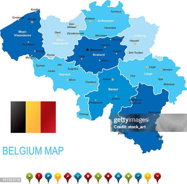
belgium - infographic map - illustration - namur stock illustrationsBelgium - Infographic map - illustrationMap, Brussels-Capital Region
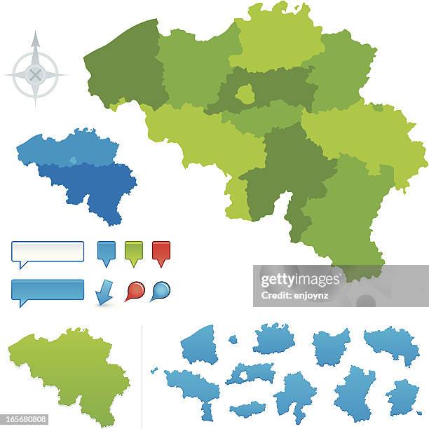
belgium vector map regions isolated - namur stock illustrationsBelgium Vector Map Regions IsolatedMap
belgium - infographic map - illustration - namur stock illustrationsBelgium - infographic map - Illustration
belgium map with regions, navigation icons and national belgian flag - namur stock illustrationsBelgium Map with Regions, Navigation Icons and National Belgian flag
map of belgium with national flag. vector vintage illustration with regions - namur stock illustrationsMap of Belgium with National Flag. Vector Vintage Illustration with Regions
map of belgium. political map with regions, national flag, geographical borders of germany, france and netherlands - namur stock illustrationsMap of Belgium. Political Map with Regions, National Flag, Geographical Borders of Germany, France and Netherlands
belgium map with national flag. high detailed blue vector illustration - namur stock illustrationsBelgium Map with National Flag. High detailed Blue vector illustration
belgium map showing provinces in french - namur stock illustrationsBelgium Map showing Provinces in French
belgium green map with regions and navigation icons - namur stock illustrationsBelgium Green Map with Regions and Navigation Icons
belgium vector map with regions, lakes, rivers, national flag and geographical borders - namur stock illustrationsBelgium Vector Map with Regions, Lakes, Rivers, National flag and Geographical Borders
belgium map. vintage illustration with regions and national flag - namur stock illustrationsBelgium Map. Vintage Illustration with Regions and National FlagMap
vintage belgium map with regions, lakes, rivers, national flag and geographical borders. vector illustration - namur stock illustrationsVintage Belgium Map with Regions, Lakes, Rivers, National flag and Geographical Borders. Vector Illustration
belgium map with national flag. vector illustration - namur stock illustrationsBelgium Map with National Flag. Vector Illustration
belgium vector map with regions, lakes, rivers, national flag and geographical borders - namur stock illustrationsBelgium Vector Map with Regions, Lakes, Rivers, National flag and Geographical Borders
belgium map with regions and national belgian flag - namur stock illustrationsBelgium Map with Regions and National Belgian flag
belgium vector map. political map with regions, geographical borders of france, luxembourg, germany and netherlands - namur stock illustrationsBelgium Vector Map. Political Map with Regions, Geographical Borders of France, Luxembourg, Germany and Netherlands
belgium map with national flag. vector blue illustration with regions and capital cities - namur stock illustrationsBelgium Map with National Flag. Vector Blue Illustration with Regions and Capital Cities
belgium map with regions, navigation icons and national flag. file contains separated regions - namur stock illustrationsBelgium Map with Regions, Navigation Icons and National Flag. File contains separated Regions
belgium map with regions, navigation icons and national belgian flag - namur stock illustrationsBelgium Map with Regions, Navigation Icons and National Belgian flag
belgium map with regions and national belgian flag - namur stock illustrationsBelgium Map with Regions and National Belgian flag
belgium map with regions, navigation icons and national belgian flag - namur stock illustrationsBelgium Map with Regions, Navigation Icons and National Belgian flagBrussels-Capital Region
belgium vector map. political golden map with regions, geographical borders of germany, france, netherlands and luxembourg - namur stock illustrationsBelgium Vector Map. Political Golden Map with Regions, Geographical Borders of Germany, France, Netherlands and Luxembourg
map of belgium. political map with regions, geographical borders of france, luxembourg, germany and netherlands - namur stock illustrationsMap of Belgium. Political Map with Regions, Geographical Borders of France, Luxembourg, Germany and NetherlandsCity, Map
belgium map. vintage illustration with regions and national flag - namur stock illustrationsBelgium Map. Vintage Illustration with Regions and National Flag
belgium vector map. political map with regions, geographical borders of france, luxembourg, germany and netherlands - namur stock illustrationsBelgium Vector Map. Political Map with Regions, Geographical Borders of France, Luxembourg, Germany and Netherlands