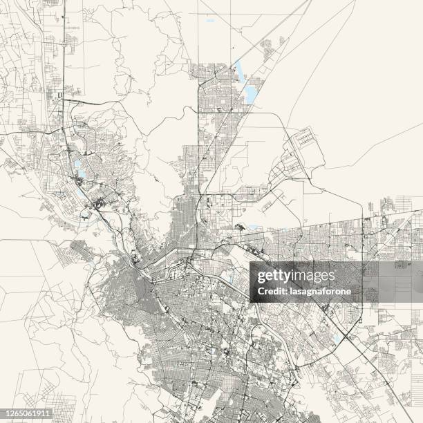
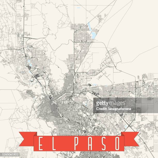
el paso, texas, usa vector map - el paso map stock illustrationsEl Paso, Texas, USA Vector MapMap, El Paso - Texas, Texas
el paso texas us city street map - el paso map stock illustrationsEl Paso Texas US City Street MapEl Paso - Texas, Map, Texas
map of the state of texas, usa 1883 - el paso map stock illustrationsMap of the state of Texas, USA 1883Map, Texas, El Paso - Texas
texas us state vector road map grey - el paso map stock illustrationsTexas US State Vector Road Map GreyTexas, Map, City
el paso, texas, usa vector map - el paso map stock illustrationsEl Paso, Texas, USA Vector MapEl Paso - Texas, Texas, Map
el paso, texas, usa vector map - el paso map stock illustrationsEl Paso, Texas, USA Vector MapTexas, El Paso - Texas, Map
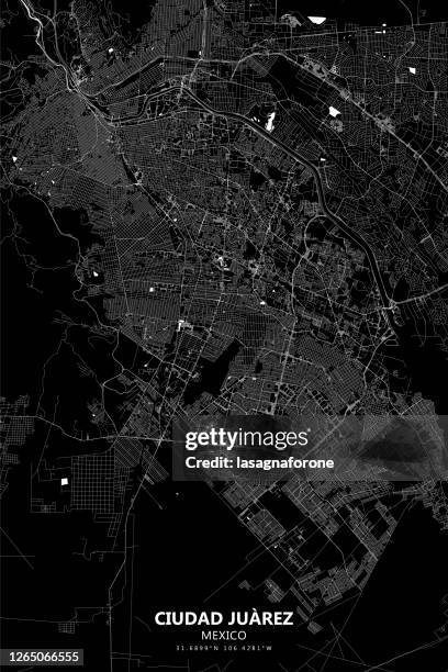
ciudad juarez, mexico vector map - el paso map stock illustrationsCiudad Juarez, Mexico Vector MapMexico, City Map, Texas
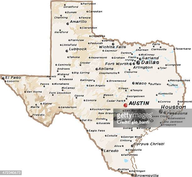
cartoon map of texas - el paso map stock illustrationsCartoon map of TexasTexas, Texas State Flag, Austin - Texas
el paso county, texas. map in retro vintage style - old textured paper - el paso map stock illustrationsEl Paso County, Texas. Map in retro vintage style - Old textured paperMap, El Paso - Texas
ciudad juarez, mexico vector map - el paso map stock illustrationsCiudad Juarez, Mexico Vector MapArchitecture, El Paso - Texas, Map
texas cities topographic map - el paso map stock pictures, royalty-free photos & imagesTexas Cities Topographic MapMap, Texas, Houston - Texas
texas vector map regions isolated - el paso map stock illustrationsTexas Vector Map Regions IsolatedMap, Texas, Houston - Texas
texas map with traditional state items illustration - el paso map stock illustrationsTexas map with traditional state items illustrationTexas, Map, Houston - Texas
The Franklin Mountains, in El Paso, Texas, form a tilted fault block from Basin and Range style crustal extension. Ordovician El Paso Formation makes...The Franklin Mountains, in El Paso, Texas, form a tilted fault block from Basin and Range style crustal extension. Ordovician El Paso Formation makes up the thin-bedded rocks in the photo.
el paso county, texas. map on blue and red background - el paso map stock illustrationsEl Paso County, Texas. Map on blue and red backgroundTexas, Map, El Paso County - Texas
map of the state of washington, usa 1883 - el paso map stock illustrationsMap of the state of Washington, USA 1883Archival, Washington State, Map
map of the state of texas 1865 - el paso map stock illustrationsMap of the state of Texas 1865Texas, Map, Archival
cartoon map of texas - el paso map stock illustrationsCartoon map of TexasTexas, Map, Houston - Texas
cartoon map of texas - el paso map stock illustrationsCartoon map of TexasTexas, Houston - Texas, Map
cartoon map of texas - el paso map stock illustrationsCartoon map of TexasMap, Texas, Galveston - Texas
Year old Nathan Bacchus, left, and 9 year old Michel Bacchus check the map as they try to find their way out of the 10-acre cornfield maze October...Cornfield Maze in La Union, New MexicoCorn Maze, El Paso - Texas
ciudad juarez, mexico vector map - el paso map stock illustrationsCiudad Juarez, Mexico Vector MapMap, Ciudad Juarez, Mexico
Map is displayed with pins marking locations where asylum seekers will travel to meet their sponsors, in a shelter for migrants who are seeking...Swelling Numbers Of Migrants Overwhelm Southern Border CrossingsUSA, Map
Map of Texas is displayed on a parking spot at the Old Glory Memorial in El Paso, Texas, U.S., on Wednesday, Feb. 27, 2019. President Trump, while...A Border Town In The Middle Of A Political DebateMap, Texas
Columbus, Ohio was ranked as the best city for commuters due to its speedy and cost-effective commutes and active downtown core. Data Source: Lyft.Ranked: The Best U.S. Cities For CommutersUSA, Downtown District, Map
texas fruits map - el paso map stock illustrationsTexas Fruits MapLaredo - Texas, Houston - Texas, Texas
Aerial view of tilted Ordovician sedimentary rock of the Franklin Mountains and El Paso, Texas.Aerial view of tilted Ordovician sedimentary rock of the Franklin Mountains and El Paso, TexasMountain, Texas
Aerial view of tilted Ordovician sedimentary rock of the Franklin Mountains and El Paso, Texas.Aerial view of tilted Ordovician sedimentary rock of the Franklin Mountains and El Paso, TexasMountain, Texas
el paso, texas, usa vector map - el paso map stock illustrationsEl Paso, Texas, USA Vector MapDesert Area, El Paso - Texas, Geographical Border
ciudad juarez, mexico vector map - el paso map stock illustrationsCiudad Juarez, Mexico Vector MapMexico, Map, Geographical Border
el paso, texas, usa vector map - el paso map stock illustrationsEl Paso, Texas, USA Vector MapEl Paso - Texas, Ciudad Juarez, Texas
el paso, texas, usa vector map - el paso map stock illustrationsEl Paso, Texas, USA Vector MapCiudad Juarez, Map
cartoon map of arizona state - el paso map stock illustrationsCartoon map of Arizona StatePhoenix - Arizona, Map, Arizona State Capitol
Guatemalan woman looks at a map of the United States at the Casa del Refugiado, or The House of Refugee, a new centre opened by the Annunciation...TOPSHOT-US-MEXICO-POLITICS-SECURITY-BORDERRefugee, USA, Map
https://legacy.lib.utexas.edu/maps/states/colorado.gif - el paso map stock illustrationshttps://legacy.lib.utexas.edu/maps/states/colorado.gifMap
Graphic of a map of the Canary Islands, at the Instituto Geolico Nacional , in the Plaza de Tajuya on December 25, 2021 in Tajuya, El Paso, La Palma,...Cumbre Vieja VolcanoCanary Islands, Map
Guatemalan woman touches a map of the United States at the Casa del Refugiado, or The House of Refugee, a new centre opened by the Annunciation House...US-MEXICO-POLITICS-SECURITY-BORDERMap, USA
Stereograph of Castle Rocks on the Divide, near Monument, El Paso County, Colorado, 1874. Image courtesy USGS. .Castle Rocks On The Divide
Stereograph of a tree study on tableland near Palmer Lake, El Paso County, Colorado, 1874. Image courtesy USGS. .Tree Study On Tableland
Members of the Military Emergency Unit look at a map of the island of La Palma at a field emergency post set up on the outskirts of the town of El...SPAIN-FIRE
Members of the Military Emergency Unit look at a map of the island of La Palma at a field emergency post set up on the outskirts of the town of El...SPAIN-FIRE
Members of the Military Emergency Unit look at a map of the island of La Palma at a field emergency post set up on the outskirts of the town of El...SPAIN-FIRE
sun rays between pine trees - el paso map stock pictures, royalty-free photos & imagesSun rays between pine trees
Tablelands on Colorado Divide, El Paso County, Colorado, 1874. Image courtesy USGS. .Tablelands On Colorado Divide
Castle Rocks on the Divide, near Monument, El Paso County, Colorado, 1874. Image courtesy USGS. .Castle Rocks On The Divide
Natural arch under Castle Rock, near Monument, El Paso County, Colorado, 1874. Image courtesy USGS. .Natural Arch Under Castle Rock
Studies in Monument Park, El Paso County, Colorado, 1874. Image courtesy USGS. .Studies In Monument Park