victorian map of the north polar regions - nautical map stock illustrationsVictorian map of the North Polar RegionsNautical Chart, Map, Old
vintage compass - nautical map stock illustrationsVintage CompassNavigational Compass, Old-fashioned, Retro Style
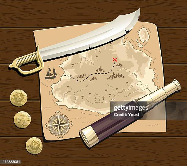
vintage map background - nautical map stock illustrationsVintage map backgroundNautical Chart, Vector, Treasure Map
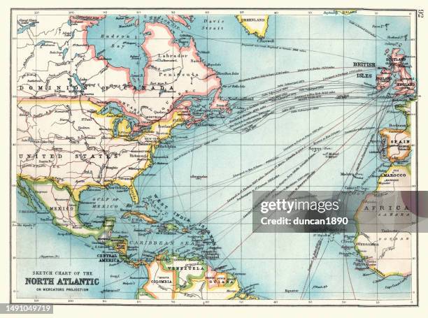
old sketch chart of the north atlantic on mercator projection, shipping routes, europe, north and south america, 1890s, 19th century - nautical map stock illustrationsOld Sketch chart of the North Atlantic on Mercator projection, Shipping routes, Europe, North and South America, 1890s, 19th CenturyMap, Nautical Chart, Archival
antique map, sea chart of strait of gibraltar, victorian 1890s, 19th century - nautical map stock illustrationsAntique map, Sea chart of Strait of Gibraltar, Victorian 1890s, 19th CenturyNautical Chart, Map, Straits Of Gibraltar
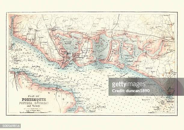
antique map of portsmouth, portsea and spithead, england, 1880 - nautical map stock illustrationsAntique Map of Portsmouth, Portsea and Spithead, England, 1880Nautical Chart, Old-fashioned, Retro Style
vector drawing of a compass rose - nautical map stock illustrationsVector drawing of a compass roseMap, Old, Old-fashioned
circulus aequinoctalis, historical map showing the equator and sailing ships - nautical map stock illustrationscirculus aequinoctalis, historical map showing the equator and sailing shipsNautical Chart, The Past, Map
map of ocean currents - nautical map stock illustrationsMap of Ocean CurrentsNautical Chart, Old-fashioned, Old
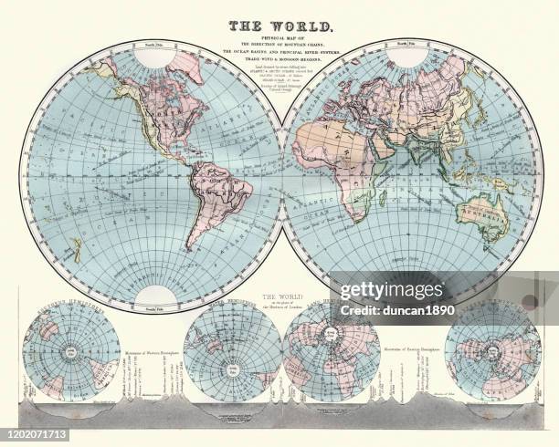
antique chart of the world - nautical map stock illustrationsAntique Chart of the WorldNautical Chart, Sea, Chart
map showing course of the spanish armada round england - nautical map stock illustrationsMap showing course of the Spanish Armada round EnglandMap, Old, The Past
old wind rose compass - nautical map stock illustrationsOld wind rose compassCompass Rose, Navigational Compass, Retro Style
antquie map of the bristol channel, 1880 - nautical map stock illustrationsAntquie Map of the Bristol Channel, 1880Nautical Chart, Map, Antique
map of manila bay, philippines, victorian, vintage illustration 1870s 19th century - nautical map stock illustrationsMap of Manila Bay, Philippines, Victorian, Vintage illustration 1870s 19th CenturyNautical Chart, Archival, Old-fashioned
map of plymouth sound and the breakwater, victorian 19th century - nautical map stock illustrationsMap of Plymouth Sound and the Breakwater, Victorian 19th CenturyNautical Chart, Archival, Old-fashioned
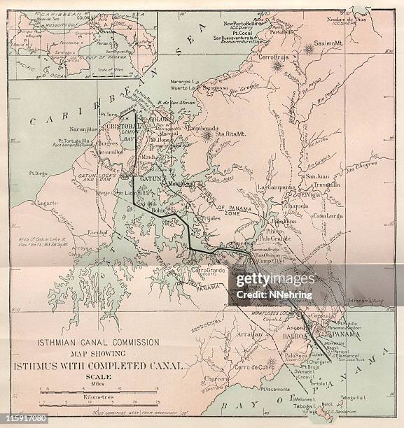
antique panama canal map - nautical map stock illustrationsantique Panama Canal mapMap, Panama Canal, Nautical Chart
antique map of british isles and surrounding seas - nautical map stock illustrationsAntique map of British Isles and Surrounding SeasNautical Chart, North Sea, The Past
antique wind rose map on old paper - nautical map stock illustrationsAntique Wind Rose Map on Old PaperNautical Chart, Antique, Chart
vector drawing of a compass rose - nautical map stock illustrationsVector drawing of a compass roseCompass Rose, Engraving, Vector
maps for history of geography - nautical map stock illustrationsMaps for history of geographyNautical Chart, World Map, Antique
excerpts of nautical charts, lithograph, published in 1897 - nautical map stock illustrationsExcerpts of nautical charts, lithograph, published in 1897Nautical Chart, Map, Helgoland
a cartoon drawing of a map with a compass - nautical map stock illustrationsA cartoon drawing of a map with a compassMap, Old, Treasure Map
plan of boston harbour in the 18th century - nautical map stock illustrationsPlan of Boston harbour in the 18th CenturyNautical Chart, Map, History
map of novaya zemlya - nautical map stock illustrationsMap of Novaya ZemlyaNautical Chart, Old, Arctic
history of astronomy, star chart, march 1883, night sky over port elizabeth, algoa bay, eastern cape, south africa, victorian 19th century vintage illustration - nautical map stock illustrationsHistory of astronomy, Star chart, March 1883, Night sky over Port Elizabeth, Algoa Bay, Eastern Cape, South Africa, Victorian 19th Century vintage illustrationSky, Star - Space, Night
map of the naval campaign of 1898 in the west indies, spanish–american war, 1890s 19th century military history - nautical map stock illustrationsMap of the Naval campaign of 1898 in the West Indies, Spanish–American War, 1890s 19th Century MIlitary HistoryNautical Chart, Archival, Old-fashioned
map of plant geography - nautical map stock illustrationsMap of plant geographyNautical Chart, Old-fashioned, World Map
map of milford haven - nautical map stock illustrationsMap of Milford HavenNautical Chart, Antique, Wales
pirates treasure map - nautical map stock illustrationsPirates Treasure MapNautical Chart, Treasure Map, Map
map of labuan island, malaysia, 19th century - nautical map stock illustrationsMap of Labuan Island, Malaysia, 19th CenturyNautical Chart, The Past, Old
route icons - line series - nautical map stock illustrationsRoute Icons - Line SeriesRoad, Bookmark, Nautical Chart
map of kingston and port royal, jamaica, 19th century - nautical map stock illustrationsMap of Kingston and Port Royal, Jamaica, 19th CenturyNautical Chart, Jamaica, Map
isometric 3d map with red pin over the city. - nautical map stock illustrationsIsometric 3d map with red pin over the city.Three Dimensional, Map Pin Icon, Map
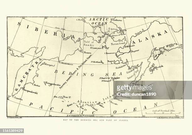
map of the behring sea and part of alaska, 1891 - nautical map stock illustrationsMap of the Behring Sea and part of Alaska, 1891Nautical Chart, Alaska - US State, Bering Sea
pirate editable stroke icon set - nautical map stock illustrationsPirate Editable Stroke Icon SetIcon Symbol, Pirate - Criminal, Treasure Chest
map of saint john, new brunswick, canada 19th century - nautical map stock illustrationsMap of Saint John, New Brunswick, Canada 19th CenturyNautical Chart, Old, The Past
seafaring and shipping concept in realistic style. lifebuoy with an original drawing of a barque ship against the background of deck boards. creative stylish poster or banner with place for text. - nautical map stock illustrationsSeafaring and shipping concept in realistic style. Lifebuoy with an original drawing of a barque ship against the background of deck boards. Creative stylish poster or banner with place for text.Nautical Chart, Sailing, Nautical Vessel
navigation icon set. location and gps symbol. editable stroke thin line map icon set. locate pin position vector - nautical map stock illustrationsNavigation icon set. Location and GPS symbol. Editable stroke thin line Map icon set. Locate pin position vectorIcon Symbol, Direction, Map
geographic direction symbol north east south west drawing - nautical map stock illustrationsGeographic Direction Symbol North East South West DrawingNavigational Compass, Nautical Chart
antique map of the world, 19th century - nautical map stock illustrationsAntique map of the world, 19th CenturyWorld Map, Nautical Chart, Archival
pirates treasure map - nautical map stock illustrationsPirates Treasure MapMap, Pirate - Criminal, Antique
phone video stream - nautical map stock illustrationsphone video streamVertical, Movie, Live Streaming
sea holiday concept in retro style. hand drawn drawing of a sea vessel on the open sea with seagulls. vector graphic illustration in an oval on a seamless sea background. - nautical map stock illustrationsSea holiday concept in retro style. Hand drawn drawing of a sea vessel on the open sea with seagulls. Vector graphic illustration in an oval on a seamless sea background.Engraved Image, Nautical Chart, Retro Style
british royal navy officers looking at a map charting a course, scene from the admiral's misadventure, design, victorian vintage illustration 19th century - nautical map stock illustrationsBritish Royal Navy Officers looking at a map charting a course, Scene from The Admiral's Misadventure, Design, Victorian Vintage Illustration 19th CenturyMap, Ship, Sailor
wind rose compass - nautical map stock illustrationsWind rose compassNautical Chart, Vector, Compass Rose
france waterways map 1887 - nautical map stock illustrationsFrance Waterways map 1887Nautical Chart, Old, History
pirates treasure map - nautical map stock illustrationsPirates Treasure MapPirate - Criminal, Nautical Chart, Illustration
illustration of global communications with dotted lines - nautical map stock illustrationsIllustration of global communications with dotted linesNautical Chart, Illustration
spanish demarcation map of the new world - nautical map stock illustrationsSpanish demarcation map of the New WorldMap, Brazil, Old
nautical editable stroke icon set - nautical map stock illustrationsNautical Editable Stroke Icon SetFlag