antique map of british isles and surrounding seas - english channel map stock illustrationsAntique map of British Isles and Surrounding SeasNautical Chart, North Sea, The Past
antique map of channel islands - english channel map stock illustrationsAntique map of Channel IslandsMap, English Channel, Channel Islands - England
antique map, channel island, jersey, guernsey, alderney 19th century - english channel map stock illustrationsAntique map, Channel Island, Jersey, Guernsey, Alderney 19th CenturyIsland, Map, Guernsey
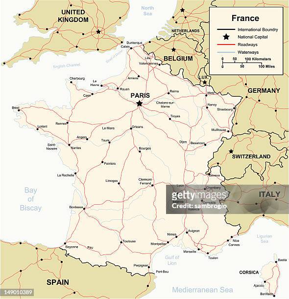
france map showing regions - english channel map stock illustrationsFrance Map showing RegionsMap, France, Belgium
united kingdom map watercolor painting. raster illustration. - english channel map stock illustrationsUnited Kingdom Map Watercolor Painting. Raster Illustration.Map, UK, Abstract
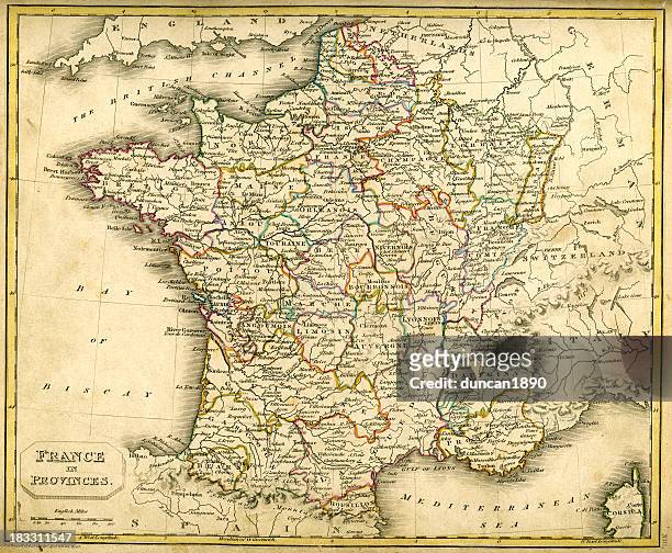
antquie map of france in provinces - english channel map stock illustrationsAntquie Map of France in ProvincesMap, France, Brittany - France
antique map of france - 19th century - english channel map stock illustrationsAntique Map of France - 19th CenturyMap, Old-fashioned, Archival
1883 british isles map - english channel map stock illustrations1883 British Isles MapMap, English Channel, UK
map of the english channel - english channel map stock illustrationsMap of the English channelVector, Canal, Wire-frame Model
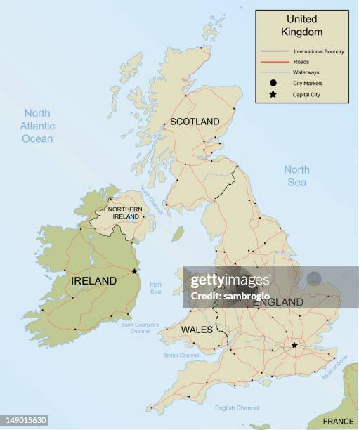
united kingdom simple big map - english channel map stock illustrationsUnited Kingdom simple big mapMap, UK, Shetland Islands
map of alderney and the casquets - english channel map stock illustrationsMap of Alderney and the CasquetsMap, Sea, English Channel
travel vector map london paris brussels - english channel map stock illustrationsTravel Vector Map London Paris BrusselsMap, France, Belgium
guernsey map in retro vintage style - old textured paper - english channel map stock illustrationsGuernsey map in retro vintage style - Old textured paperGuernsey, Map
map of south east england, hampshire, dorset, wiltshire 1891 - english channel map stock illustrationsMap of South East England, Hampshire, Dorset, Wiltshire 1891Map, Wiltshire
travel vector map london glasgow - english channel map stock illustrationsTravel Vector Map London GlasgowRoad Map, UK, Map
folkestone kent uk city street map - english channel map stock illustrationsFolkestone Kent UK City Street MapAerial View, Harbor, Map
guernsey maps for design - black, outline, mosaic and white - english channel map stock illustrationsGuernsey maps for design - Black, outline, mosaic and whiteGuernsey, Map, Outline
united kingdom map watercolor painting. raster illustration. - english channel map stock illustrationsUnited Kingdom Map Watercolor Painting. Raster Illustration.UK, Physical Geography, Paint
jersey map hand drawn on white background - trendy design - english channel map stock illustrationsJersey map hand drawn on white background - Trendy designMap, UK, Abstract
victorian plans for a channel tunnel between england and france, 1850s, 19th century - english channel map stock illustrationsVictorian plans for a channel tunnel between England and France, 1850s, 19th CenturyMap, Dover - England, Archival
jersey 3d map on gray background - english channel map stock illustrationsJersey 3D map on gray backgroundMap
a cartoon depiction of a map of the united kingdom - english channel map stock illustrationsA cartoon depiction of a map of the United Kingdom
united kingdom map illustration - english channel map stock illustrationsUnited Kingdom map illustrationMap
storm claudia 20251114 06utc precipitation map france - english channel map stock illustrationsStorm Claudia 20251114 06UTC Precipitation Map FranceStorm, Weather Map, Switzerland
old map of scotland, steel engraving, published 1857 - english channel map stock illustrationsOld map of Scotland, steel engraving, published 1857Scotland, Map, The Past
guernsey - 3d black map on white background - english channel map stock illustrationsGuernsey - 3D black map on white backgroundMap, Guernsey, Creativity
jersey maps for design. easily editable - english channel map stock illustrationsJersey maps for design. Easily editableMap, UK, Island
hand coloured antique map of sussex england - english channel map stock illustrationsHand coloured antique map of Sussex EnglandMap, UK
united kingdom map watercolor painting. raster illustration. - english channel map stock illustrationsUnited Kingdom Map Watercolor Painting. Raster Illustration.Map
united kingdom map watercolor painting. raster illustration. - english channel map stock illustrationsUnited Kingdom Map Watercolor Painting. Raster Illustration.UK, Map, Scotland
united kingdom map watercolor painting. raster illustration. - english channel map stock illustrationsUnited Kingdom Map Watercolor Painting. Raster Illustration.UK, Map, Illustration
map of the united kingdom - english channel map stock illustrationsMap of the United KingdomMap, UK, Road
guernsey map with mesh network on white background - english channel map stock illustrationsGuernsey map with mesh network on white backgroundGuernsey
jersey maps for design. blank, white and black backgrounds - line icon - english channel map stock illustrationsJersey maps for design. Blank, white and black backgrounds - Line icon
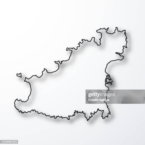
guernsey map - black outline with shadow on white background - english channel map stock illustrationsGuernsey map - Black outline with shadow on white background
jersey map with sunbeams on white background - english channel map stock illustrationsJersey map with sunbeams on white backgroundMap
jersey map with long shadow on textured yellow background - english channel map stock illustrationsJersey map with long shadow on textured yellow background
guernsey map with long shadow on blank background - flat design - english channel map stock illustrationsGuernsey map with long shadow on blank background - Flat Design
jersey map - glowing neon sign on brick wall background - english channel map stock illustrationsJersey map - Glowing neon sign on brick wall backgroundUK
eastbourne east sussex uk city street map - english channel map stock illustrationsEastbourne East Sussex UK City Street MapAerial View, Coastline
map of portland - english channel map stock illustrationsMap of PortlandRoad Map, Map, Portland - Oregon
black jersey map with long shadow on white background - flat design - english channel map stock illustrationsBlack Jersey map with long shadow on white background - Flat Design
jersey map with black outline and shadow on white background - english channel map stock illustrationsJersey map with black outline and shadow on white backgroundMap, Vector, Island
united kingdom map watercolor painting. raster illustration. - english channel map stock illustrationsUnited Kingdom Map Watercolor Painting. Raster Illustration.UK, Map, Illustration
antique map of england and wales - english channel map stock illustrationsAntique map of England and WalesMap
jersey map of dots on white background - english channel map stock illustrationsJersey map of dots on white background
guernsey map on red background with shadow - english channel map stock illustrationsGuernsey map on Red background with shadowMap, UK, Island
united kingdom map watercolor painting. raster illustration. - english channel map stock illustrationsUnited Kingdom Map Watercolor Painting. Raster Illustration.Map, UK, Scotland
ancient history, map showing the straits of dover, coasts of gaul and britain, vintage illustration, - english channel map stock illustrationsAncient history, Map showing the Straits of Dover, coasts of Gaul and Britain, Vintage illustration,Gaul - Western Europe
united kingdom map watercolor painting. raster illustration. - english channel map stock illustrationsUnited Kingdom Map Watercolor Painting. Raster Illustration.Map
antique map of the cinque ports in kent, england - 19th century - english channel map stock illustrationsAntique Map of the Cinque Ports in Kent, England - 19th CenturyCoastline, Map, Archival
map of the cinque ports (victorian engraving) - english channel map stock illustrationsMap of the Cinque Ports (Victorian engraving)Map, Coastline, Battle
jersey map - flat icons on different color buttons - english channel map stock illustrationsJersey map - Flat icons on different color buttonsIsland, Map, Channel Islands - England
historical city map of southampton, hampshire, england, woodcut, published 1897 - english channel map stock illustrationsHistorical city map of Southampton, Hampshire, England, woodcut, published 1897Southampton - England, Map, Coastline
jersey map in retro vintage style - old textured paper - english channel map stock illustrationsJersey map in retro vintage style - Old textured paperMap, Old-fashioned
jersey map drawn on chalkboard - blackboard - english channel map stock illustrationsJersey map drawn on chalkboard - BlackboardMap, Channel Islands - England
calais, france, wood engraving, published in 1882 - english channel map stock illustrationsCalais, France, wood engraving, published in 1882Town, France, Coastline
united kingdom map watercolor painting. raster illustration. - english channel map stock illustrationsUnited Kingdom Map Watercolor Painting. Raster Illustration.UK, Map