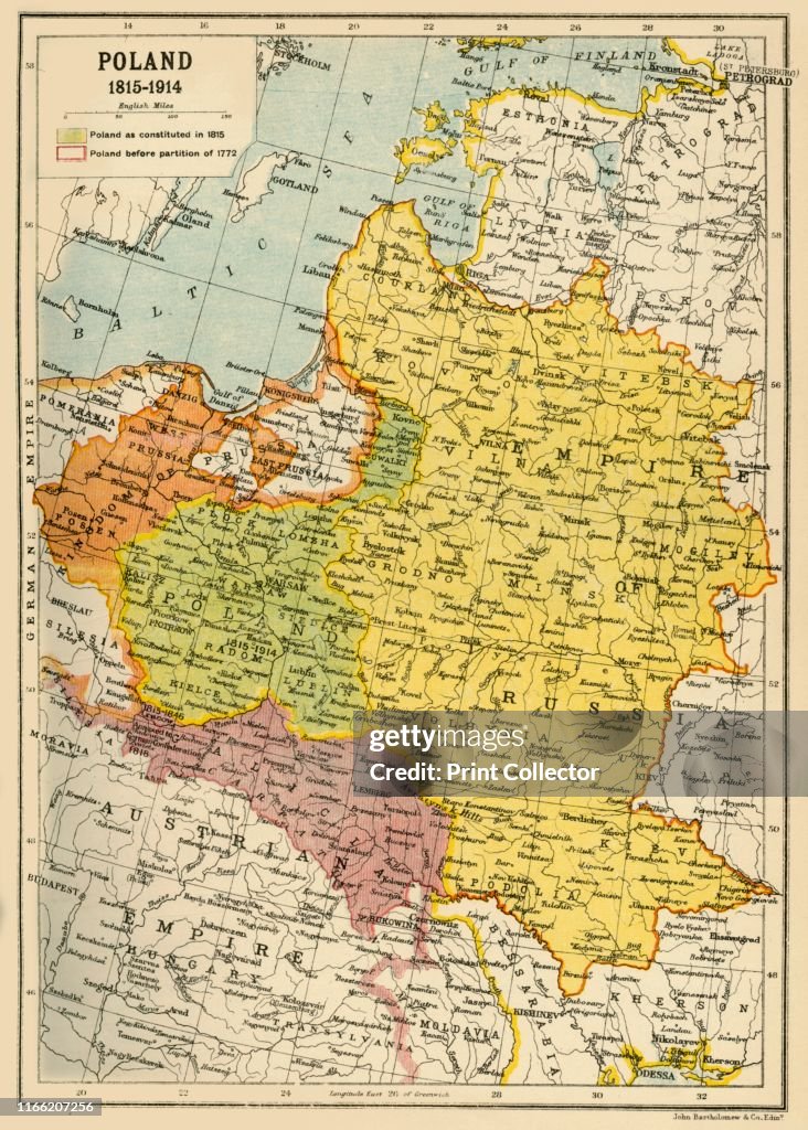
Poland
Poland, 1815-1914', (circa 1920). Map showing Polish territory from the end of the 18th century until the First World War: 'Poland as constituted in 1815', and 'Poland before partition of 1772'. From "The Great World War - A History" Volume IV, edited by Frank A Mumby. [The Gresham Publishing Company Ltd, London, circa 1920]. Artist John Bartholomew & Son. (Photo by The Print Collector via Getty Images)

PURCHASE A LICENSE
How can I use this image?
$375.00
USD
Getty ImagesPoland, News Photo Poland Get premium, high resolution news photos at Getty ImagesProduct #:1166207256
 Poland Get premium, high resolution news photos at Getty ImagesProduct #:1166207256
$499$175
Getty Images
In stockPlease note: images depicting historical events may contain themes, or have descriptions, that do not reflect current understanding. They are provided in a historical context. Learn more.
DETAILS
Restrictions:
Contact your local office for all commercial or promotional uses.
Credit:
Editorial #:
1166207256
Collection:
Hulton Archive
Date created:
January 01, 1920
Upload date:
License type:
Release info:
Not released. More information
Source:
Hulton Archive
Object name:
2717210.jpg
Max file size:
3963 x 5545 px (13.21 x 18.48 in) - 300 dpi - 6 MB
- Poland,
- Map,
- 18th Century,
- 18th Century Style,
- 1920-1929,
- British Empire,
- Galicia,
- Lithuania,
- Prussia,
- Ukraine,
- World War I,
- 1910-1919,
- 19th Century,
- 19th Century Style,
- 20th Century,
- Archival,
- Austria,
- Austrian Culture,
- Baltic Sea,
- Book,
- Coastal Feature,
- Color Image,
- Colors,
- Concepts,
- Concepts & Topics,
- Empire,
- Human Interest,
- Imperialism,
- Land,
- National Landmark,
- Occupation,
- Photography,
- Physical Geography,
- Russia,
- Sea,
- Territorial Animal,
- The Reichstag,
- Vertical,
- War,