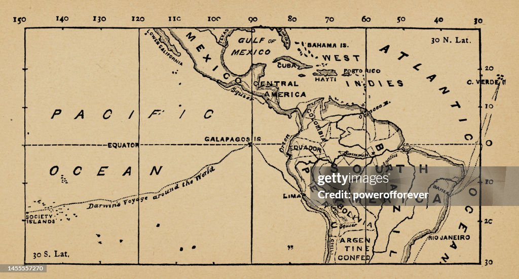
Map of South America Showing Charles Darwin’s Voyage Around the World on the HMS Beagle, Part 1 of 3 Tropic Zone Connecting Maps - 19th Century - stock illustration
Map of South America showing the route taken by Charles Darwin around the world on the Second Voyage of the HMS Beagle. This is the first map of a series of three connecting maps. Part two Africa, Part three Southeast Asia. Vintage etching circa 19th century.

Get this image in a variety of framing options at Photos.com.
PURCHASE A LICENSE
All Royalty-Free licenses include global use rights, comprehensive protection, simple pricing with volume discounts available
$375.00
USD
Getty ImagesMap Of South America Showing Charles Darwins Voyage Around The World On The Hms Beagle Part 1 Of 3 Tropic Zone Connecting Maps 19th Century High-Res Vector Graphic Download premium, authentic Map of South America Showing Charles Darwin’s Voyage Around the World on the HMS Beagle, Part 1 of 3 Tropic Zone Connecting Maps - 19th Century stock illustrations from Getty Images. Explore similar high-resolution stock illustrations in our expansive visual catalogue.Product #:1455557270
 Download premium, authentic Map of South America Showing Charles Darwin’s Voyage Around the World on the HMS Beagle, Part 1 of 3 Tropic Zone Connecting Maps - 19th Century stock illustrations from Getty Images. Explore similar high-resolution stock illustrations in our expansive visual catalogue.Product #:1455557270
$375$50
Getty Images
In stockDETAILS
Credit:
Creative #:
1455557270
License type:
Collection:
DigitalVision Vectors
Max file size:
9645 x 5183 px (32.15 x 17.28 in) - 300 dpi - 34 MB
Upload date:
Release info:
Property released
Categories:
- Map,
- Galapagos Islands,
- Old,
- South America,
- The Past,
- Beagle,
- Charles Darwin - Naturalist,
- Engraved Image,
- Engraving,
- Exploration,
- Journey,
- Horizontal,
- Old-fashioned,
- Archival,
- Etching,
- Explorer,
- History,
- 19th Century,
- 19th Century Style,
- Adventure,
- Antique,
- Cultures,
- Direction,
- Discovery,
- Fame,
- Geographical Border,
- Historical Geopolitical Location,
- Illustration,
- Latitude,
- Lithograph,
- Longitude,
- Major Ocean,
- Mode of Transport,
- News Event,
- No People,
- Pacific Ocean,
- Science,
- Scientist,
- Sea,
- Ship,
- South American Culture,
- Styles,
- Text,
- Thoroughfare,
- Topographic Map,
- Topography,
- Transportation,
- Travel Destinations,
- UNESCO World Heritage Site,
- Victorian Style,
- Western Script,