usa red blue map all fifty states - oh stock illustrationsUSA Red Blue Map All Fifty StatesMap, Election, Party - Social Event
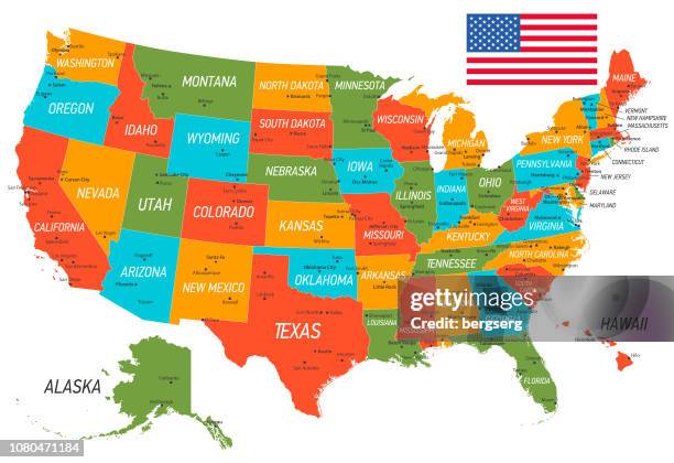
united states of america map. vector map with states and national flag - oh stock illustrationsUnited States of America Map. Vector Map with states and national flagUSA, Map, Vector
antique photograph: high street, columbus, ohio - oh stock illustrationsAntique photograph: High Street, Columbus, OhioColumbus - Ohio, Ohio, History
rocky mountain and pacific states map 1881 - oh stock illustrationsRocky Mountain and Pacific states Map 1881Map, Idaho, Old-fashioned
ohio 3d map on gray background - oh stock illustrationsOhio 3D Map on gray backgroundColumbus - Ohio, Map
railroad battery protecting workmen on the philadelphia, wilmington and baltimore and ohio raiulroad american civil war engraving - oh stock illustrationsRailroad Battery Protecting Workmen on the Philadelphia, Wilmington and Baltimore and Ohio Raiulroad American Civil War EngravingArmy Soldier, Armed Forces, Baltimore - Maryland
map of all the counties in the usa - oh stock illustrationsMap of all the counties in the USAMap, USA, Vector
stylized line drawings of american cities - oh stock illustrationsStylized Line Drawings of American CitiesCleveland - Ohio, Vector, Office Building Exterior
map of usa with national borders and rivers - oh stock illustrationsMap of USA with national borders and riversMap, USA, Retro Style
ohio map with a coronavirus cell (covid-19) in red viewfinder - oh stock illustrationsOhio map with a coronavirus cell (COVID-19) in red viewfinder
usa map with pins - highly detailed - oh stock illustrationsUSA Map With Pins - Highly DetailedMap, Vector, USA
ohio state flag, vector circle icon - oh stock illustrationsOhio State Flag, vector circle iconOhio State Flag, Circle, Ohio
stark county, ohio. map in retro vintage style - old textured paper - oh stock illustrationsStark County, Ohio. Map in retro vintage style - Old textured paperOhio, District
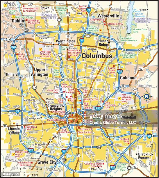
toledo oh area 120k vector road map beige - oh stock illustrationsToledo OH Area 120K Vector Road Map Beige
port clinton, ohio raster watercolor map illustration - oh stock illustrationsPort Clinton, Ohio Raster Watercolor Map IllustrationOhio, Heart Shape
jefferson county, ohio maps for design. easily editable - oh stock illustrationsJefferson County, Ohio maps for design. Easily editableOhio
ohio maps - mosaic squarred and dotted - oh stock illustrationsOhio maps - Mosaic squarred and dotted
house of william mckinley in canton, ohio - oh stock illustrationsHouse of William McKinley in Canton, OhioOhio
ohio map on gold background - circular brushed metal texture - oh stock illustrationsOhio map on gold background - Circular brushed metal textureOhio, Prosperity
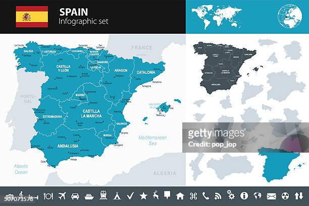
spain map - infographic set - oh stock illustrationsSpain Map - Infographic SetMap, Barcelona - Spain, Madrid
usa - highway map on american flag background - oh stock illustrationsUSA - Highway Map on American Flag BackgroundRoad Map, USA, Map
superior street in cleveland from presbyterian church, cleveland, ohio, united states, american victorian engraving, 1872 - oh stock illustrationsSuperior Street in Cleveland from Presbyterian Church, Cleveland, Ohio, United States, American Victorian Engraving, 1872Ohio, Engraving, Archival
history and landmarks of usa: music hall, cincinnati, ohio - oh stock illustrationsHistory and landmarks of USA: Music Hall, Cincinnati, OhioCincinnati, Archival, History
retro united state travel map - oh stock illustrationsRetro United State Travel MapMap, Wisconsin, USA
missouri us state vector road map grey - oh stock illustrationsMissouri US State Vector Road Map GreyMap, Springfield - Missouri, Town
spain - infographic map - illustration - oh stock illustrationsSpain - Infographic map - illustrationMap, Spain, Madrid
ohio map icon, flat design, long shadow - oh stock illustrationsOhio map icon, Flat Design, Long ShadowOhio, Map, District
michigan map - watercolor style - oh stock illustrationsMichigan map - Watercolor styleGreat Lakes, Map, Mackinac Island
ohio map for design, long shadow, flat design - oh stock illustrationsOhio Map for design, Long Shadow, Flat Design
the united states of america - oh stock illustrationsThe United States of AmericaHawaii Islands, California
antique illustration of usa, ohio landmarks and companies: cincinnati, the enquirer - oh stock illustrationsAntique illustration of USA, Ohio landmarks and companies: Cincinnati, The EnquirerCincinnati, Ohio
antique map of cincinnati (1899) - oh stock illustrationsAntique map of Cincinnati (1899)Map, Cincinnati, Old-fashioned
vector world map geography of united states - oh stock illustrationsVector World Map Geography of United States
map of great lakes and animals - oh stock illustrationsMap of Great Lakes and animalsIcon Symbol, Map, Vector
youngstown oh city vector road map blue text - oh stock illustrationsYoungstown OH City Vector Road Map Blue TextYoungstown - Ohio, Road Map, Ohio
vintage world war ii propaganda poster. - oh stock illustrationsVintage World War II propaganda poster.World War II, The Past
map of new york, new jersey 1871 - oh stock illustrationsMap of New York, New Jersey 1871Map, Delaware - US State, New Jersey
red mill falls, black river near elyria, ohio, united states, american victorian engraving, 1872 - oh stock illustrationsRed Mill Falls, Black River Near Elyria, Ohio, United States, American Victorian Engraving, 1872Waterfall, Art, Etching
lumber boats, sandusky, ohio, united states, american victorian engraving, 1872 - oh stock illustrationsLumber Boats, Sandusky, Ohio, United States, American Victorian Engraving, 1872Engraving, Ohio
blue map of usa with paper cut effect - oh stock illustrationsBlue map of USA with paper cut effectUSA, Alaska - US State, Map
ohio map with the spread of covid-19. coronavirus outbreak - oh stock illustrationsOhio map with the spread of COVID-19. Coronavirus outbreak