historic atlas of the topography of massachusetts, usa, 1890 - cape cod ma stock illustrationsHistoric Atlas of the Topography of Massachusetts, USA, 1890
historical atlas of the topography of massachusetts, usa, 1890 - cape cod ma stock illustrationsHistorical Atlas of the Topography of Massachusetts, USA, 1890
historical atlas of the topography of massachusetts, usa, 1890 - cape cod ma stock illustrationsHistorical Atlas of the Topography of Massachusetts, USA, 1890
historical atlas of the topography of massachusetts, usa, 1890 - cape cod ma stock illustrationsHistorical Atlas of the Topography of Massachusetts, USA, 1890
historical atlas of the topography of massachusetts, usa, 1890 - cape cod ma stock illustrationsHistorical Atlas of the Topography of Massachusetts, USA, 1890
historical atlas of the topography of massachusetts, usa, 1890 - cape cod ma stock illustrationsHistorical Atlas of the Topography of Massachusetts, USA, 1890
historical atlas of the topography of massachusetts, usa, 1890 - cape cod ma stock illustrationsHistorical Atlas of the Topography of Massachusetts, USA, 1890
historical atlas of the topography of massachusetts, usa, 1890 - cape cod ma stock illustrationsHistorical Atlas of the Topography of Massachusetts, USA, 1890
historical atlas of the topography of massachusetts, usa, 1890 - cape cod ma stock illustrationsHistorical Atlas of the Topography of Massachusetts, USA, 1890
historical atlas of the topography of massachusetts, usa, 1890 - cape cod ma stock illustrationsHistorical Atlas of the Topography of Massachusetts, USA, 1890
historical atlas of the topography of massachusetts, usa, 1890 - cape cod ma stock illustrationsHistorical Atlas of the Topography of Massachusetts, USA, 1890
historical atlas of the topography of massachusetts, usa, 1890 - cape cod ma stock illustrationsHistorical Atlas of the Topography of Massachusetts, USA, 1890
historical atlas of the topography of massachusetts, usa, 1890 - cape cod ma stock illustrationsHistorical Atlas of the Topography of Massachusetts, USA, 1890
historical atlas of the topography of massachusetts, usa, 1890 - cape cod ma stock illustrationsHistorical Atlas of the Topography of Massachusetts, USA, 1890
historic atlas of the topography of massachusetts, usa, 1890 - cape cod ma stock illustrationsHistoric Atlas of the Topography of Massachusetts, USA, 1890Old-fashioned, Archival, Retro Style
worcester, massachusetts vector watercolor map - cape cod ma stock illustrationsWorcester, Massachusetts Vector Watercolor Map
historical atlas of the topography of massachusetts, usa, 1890 - cape cod ma stock illustrationsHistorical Atlas of the Topography of Massachusetts, USA, 1890
historic atlas of the topography of massachusetts, usa, 1890 - cape cod ma stock illustrationsHistoric Atlas of the Topography of Massachusetts, USA, 1890Map
historic atlas of the topography of massachusetts, usa, 1890 - cape cod ma stock illustrationsHistoric Atlas of the Topography of Massachusetts, USA, 1890
historical atlas of the topography of massachusetts, usa, 1890 - cape cod ma stock illustrationsHistorical Atlas of the Topography of Massachusetts, USA, 1890Map, Old-fashioned, Archival
historical atlas of the topography of massachusetts, usa, 1890 - cape cod ma stock illustrationsHistorical Atlas of the Topography of Massachusetts, USA, 1890
historical atlas of the topography of massachusetts, usa, 1890 - cape cod ma stock illustrationsHistorical Atlas of the Topography of Massachusetts, USA, 1890
massachusetts state illustrated map - cape cod ma stock illustrationsMassachusetts State Illustrated Map
massachusetts state illustrated map - cape cod ma stock illustrationsMassachusetts State Illustrated Map
national seashore luggage label or travel sticker - cape cod ma stock illustrationsNational Seashore luggage label or travel sticker
ma barnstable town vector road map - cape cod ma stock illustrationsMA Barnstable Town Vector Road Map
map of massachusetts with watercolor texture - raster illustration - cape cod ma stock illustrationsMap of Massachusetts with Watercolor Texture - Raster Illustration
ma barnstable yarmouth vector road map - cape cod ma stock illustrationsMA Barnstable Yarmouth Vector Road MapMassachusetts, Map
eastham locks, manchester ship canal - cape cod ma stock illustrationsEastham Locks, Manchester Ship Canal
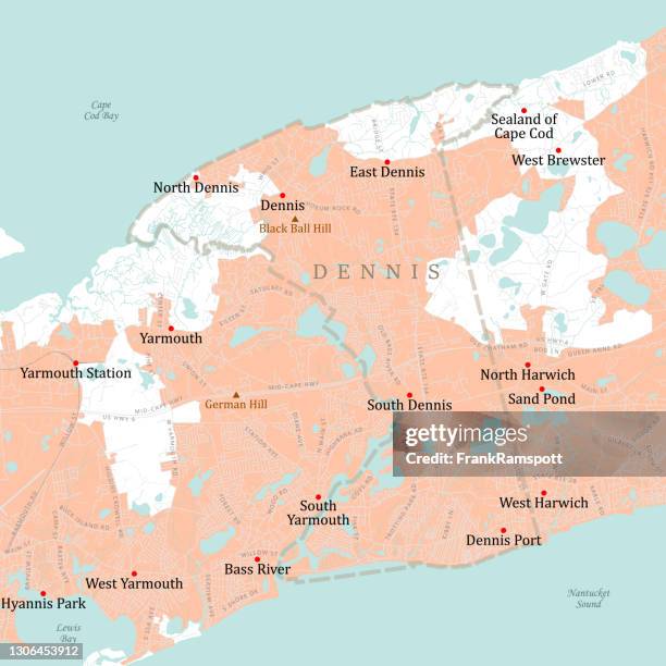
ma barnstable dennis vector road map - cape cod ma stock illustrationsMA Barnstable Dennis Vector Road Map
ma barnstable eastham vector road map - cape cod ma stock illustrationsMA Barnstable Eastham Vector Road Map
historic atlas of the topography of massachusetts, usa, 1890 - cape cod ma stock illustrationsHistoric Atlas of the Topography of Massachusetts, USA, 1890
historic atlas of the topography of massachusetts, usa, 1890 - cape cod ma stock illustrationsHistoric Atlas of the Topography of Massachusetts, USA, 1890
historic atlas of the topography of massachusetts, usa, 1890 - cape cod ma stock illustrationsHistoric Atlas of the Topography of Massachusetts, USA, 1890Old-fashioned, Archival, Retro Style
historical atlas of the topography of massachusetts, usa, 1890 - cape cod ma stock illustrationsHistorical Atlas of the Topography of Massachusetts, USA, 1890
historic atlas of the topography of massachusetts, usa, 1890 - cape cod ma stock illustrationsHistoric Atlas of the Topography of Massachusetts, USA, 1890
historic atlas of the topography of massachusetts, usa, 1890 - cape cod ma stock illustrationsHistoric Atlas of the Topography of Massachusetts, USA, 1890Map
historic atlas of the topography of massachusetts, usa, 1890 - cape cod ma stock illustrationsHistoric Atlas of the Topography of Massachusetts, USA, 1890
historical atlas of the topography of massachusetts, usa, 1890 - cape cod ma stock illustrationsHistorical Atlas of the Topography of Massachusetts, USA, 1890
construction of the manchester ship canal, eastham, 19th century - cape cod ma stock illustrationsConstruction of the Manchester Ship Canal, Eastham, 19th Century