antique photograph: provincetown, massachusetts - cape cod ma stock illustrationsAntique Photograph: Provincetown, MassachusettsOld-fashioned, Archival, Retro Style
watercolor map of massachusetts with merry christmas calligraphy. raster illustration - cape cod ma stock illustrationsWatercolor Map of Massachusetts with Merry Christmas calligraphy. Raster Illustration
massachusetts state illustrated map with cities and landmarks - cape cod ma stock illustrationsMassachusetts State Illustrated Map with Cities and Landmarks
dennis - male name - red banner, bookmark, ribbon, label on white background - cape cod ma stock illustrationsDennis - Male name - Red banner, bookmark, ribbon, label on white background
barnstable massachusetts us city street map - cape cod ma stock illustrationsBarnstable Massachusetts US City Street Map
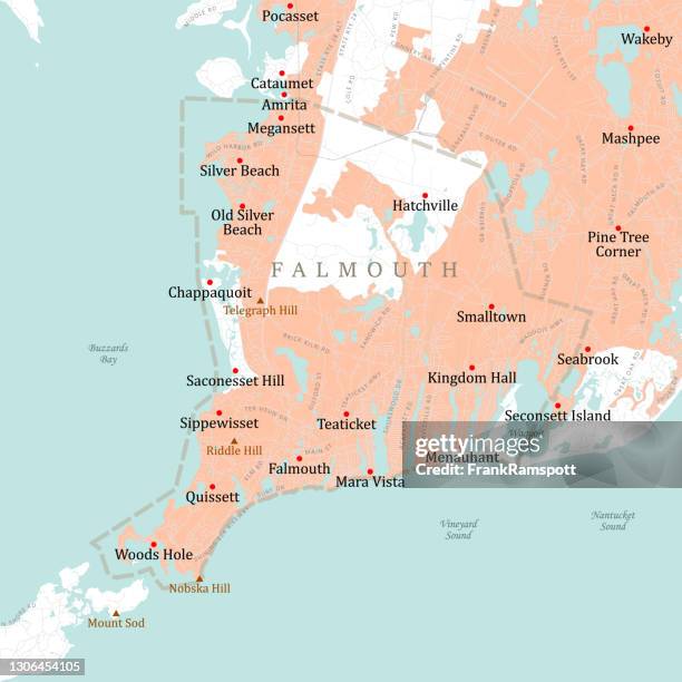
ma barnstable falmouth vector road map - cape cod ma stock illustrationsMA Barnstable Falmouth Vector Road MapMap
antique illustration of historic towns of the middle states: pittsburgh, earl of chatham - cape cod ma stock illustrationsAntique illustration of historic towns of the middle States: Pittsburgh, Earl of Chatham
welcome to massachusetts stamp illustration stock illustration - cape cod ma stock illustrationsWelcome to Massachusetts stamp illustration stock illustration
dennis - male name - red banner on white background - cape cod ma stock illustrationsDennis - Male name - Red banner on white background
historical map of north america featuring canada, united states, and mexico - cape cod ma stock illustrationsHistorical map of North America featuring Canada, United States, and Mexico
pujaries in hanuman's temple procession - cape cod ma stock illustrationsPujaries in Hanuman's Temple Procession
dennis - male name - banner, bookmark, ribbon, label on white background - cape cod ma stock illustrationsDennis - Male name - Banner, bookmark, ribbon, label on white background
massachusetts state illustrated map - cape cod ma stock illustrationsMassachusetts State Illustrated Map
pilgrim fathers signing the compact in the cabin of the mayflower. - cape cod ma stock illustrationsPILGRIM FATHERS SIGNING THE COMPACT IN THE CABIN OF THE MAYFLOWER.
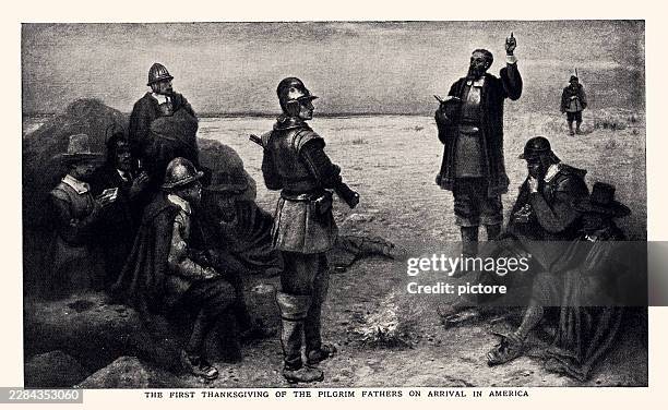
the first thanksgiving of the pilgrim fathers on arrival in america..having survived a particularly stormy passage lasting sixty-three days, the pilgrim fathers landed in massachusetts on november 11th, 1620. - cape cod ma stock illustrationsTHE FIRST THANKSGIVING OF THE PILGRIM FATHERS ON ARRIVAL IN AMERICA..Having survived a particularly stormy passage lasting sixty-three days, the Pilgrim Fathers landed in Massachusetts on November 11th, 1620.
cape cod luggage label or travel sticker - cape cod ma stock illustrationsCape Cod luggage label or travel sticker
construction of the manchester ship canal, eastham, 19th century - cape cod ma stock illustrationsConstruction of the Manchester Ship Canal, Eastham, 19th CenturyOld-fashioned, Archival, Retro Style
eastern oyster with periwinkle snail infestation - 19th century - cape cod ma stock illustrationsEastern Oyster with Periwinkle Snail Infestation - 19th CenturyAntique, Engraved Image, Engraving
historic atlas of the topography of massachusetts, usa, 1890 - cape cod ma stock illustrationsHistoric Atlas of the Topography of Massachusetts, USA, 1890Map, Massachusetts, Cape Cod
historic atlas of the topography of massachusetts, usa, 1890 - cape cod ma stock illustrationsHistoric Atlas of the Topography of Massachusetts, USA, 1890Map, History, Old-fashioned
historic atlas of the topography of massachusetts, usa, 1890 - cape cod ma stock illustrationsHistoric Atlas of the Topography of Massachusetts, USA, 1890Map, Old-fashioned, Archival
historical atlas of the topography of massachusetts, usa, 1890 - cape cod ma stock illustrationsHistorical Atlas of the Topography of Massachusetts, USA, 1890Cape Cod, Massachusetts, History
historical atlas of the topography of east massachusetts, usa, 1890 - cape cod ma stock illustrationsHistorical Atlas of the Topography of East Massachusetts, USA, 1890Map, Massachusetts, District
ma barnstable brewster vector road map - cape cod ma stock illustrationsMA Barnstable Brewster Vector Road MapCape Cod, Map
ma barnstable truro vector road map - cape cod ma stock illustrationsMA Barnstable Truro Vector Road MapMap, Cape Cod
map of massachusetts with watercolor texture - raster illustration - cape cod ma stock illustrationsMap of Massachusetts with Watercolor Texture - Raster IllustrationMap, Massachusetts, Paint
historic atlas of the topography of massachusetts, usa, 1890 - cape cod ma stock illustrationsHistoric Atlas of the Topography of Massachusetts, USA, 1890Massachusetts, Old-fashioned, Archival
cape cod luggage label or travel stickers - cape cod ma stock illustrationsCape Cod luggage label or travel stickersCape Cod
historical atlas of the topography of massachusetts, usa, 1890 - cape cod ma stock illustrationsHistorical Atlas of the Topography of Massachusetts, USA, 1890Map
ma barnstable harwich vector road map - cape cod ma stock illustrationsMA Barnstable Harwich Vector Road MapMassachusetts, Map
ma barnstable wellfleet vector road map - cape cod ma stock illustrationsMA Barnstable Wellfleet Vector Road MapMassachusetts, Map
historic atlas of the topography of massachusetts, usa, 1890 - cape cod ma stock illustrationsHistoric Atlas of the Topography of Massachusetts, USA, 1890Massachusetts, Map, Salem - Massachusetts
historical atlas of the topography of massachusetts, usa, 1890 - cape cod ma stock illustrationsHistorical Atlas of the Topography of Massachusetts, USA, 1890Massachusetts, Map, Salem - Massachusetts
historic atlas of the topography of massachusetts, usa, 1890 - cape cod ma stock illustrationsHistoric Atlas of the Topography of Massachusetts, USA, 1890Map, Massachusetts, Mountain
historical atlas of the topography of massachusetts, usa, 1890 - cape cod ma stock illustrationsHistorical Atlas of the Topography of Massachusetts, USA, 1890Massachusetts, Salem - Massachusetts, Map
historical atlas of the topography of massachusetts, usa, 1890 - cape cod ma stock illustrationsHistorical Atlas of the Topography of Massachusetts, USA, 1890Map, Mountain, Salem - Massachusetts
historical atlas of the topography of east massachusetts, usa, 1890 - cape cod ma stock illustrationsHistorical Atlas of the Topography of East Massachusetts, USA, 1890Map, Cape Cod, Old-fashioned
historical atlas of the topography of massachusetts, usa, 1890 - cape cod ma stock illustrationsHistorical Atlas of the Topography of Massachusetts, USA, 1890Map, Massachusetts, Old-fashioned
historical atlas of the topography of massachusetts, usa, 1890 - cape cod ma stock illustrationsHistorical Atlas of the Topography of Massachusetts, USA, 1890Massachusetts, Salem - Massachusetts, Map
cape cod luggage label or travel sticker - cape cod ma stock illustrationsCape Cod luggage label or travel stickerCape Cod
historical atlas of the topography of massachusetts, usa, 1890 - cape cod ma stock illustrationsHistorical Atlas of the Topography of Massachusetts, USA, 1890Massachusetts, Map, Old-fashioned
historic atlas of the topography of massachusetts, usa, 1890 - cape cod ma stock illustrationsHistoric Atlas of the Topography of Massachusetts, USA, 1890Map, Cape Cod, Old-fashioned
historical atlas of the topography of massachusetts, usa, 1890 - cape cod ma stock illustrationsHistorical Atlas of the Topography of Massachusetts, USA, 1890Massachusetts, Map, Old-fashioned
historical atlas of the topography of massachusetts, usa, 1890 - cape cod ma stock illustrationsHistorical Atlas of the Topography of Massachusetts, USA, 1890Massachusetts, Map, Salem - Massachusetts
historic atlas of the topography of massachusetts, usa, 1890 - cape cod ma stock illustrationsHistoric Atlas of the Topography of Massachusetts, USA, 1890Map, Massachusetts
historic atlas of the topography of massachusetts, usa, 1890 - cape cod ma stock illustrationsHistoric Atlas of the Topography of Massachusetts, USA, 1890Map, Massachusetts, Salem - Massachusetts
historical atlas of the topography of massachusetts, usa, 1890 - cape cod ma stock illustrationsHistorical Atlas of the Topography of Massachusetts, USA, 1890Map, Massachusetts, Old
historical atlas of the topography of massachusetts, usa, 1890 - cape cod ma stock illustrationsHistorical Atlas of the Topography of Massachusetts, USA, 1890Map, Old, USA
ma barnstable bourne vector road map - cape cod ma stock illustrationsMA Barnstable Bourne Vector Road MapMap, Massachusetts
historic atlas of the topography of massachusetts, usa, 1890 - cape cod ma stock illustrationsHistoric Atlas of the Topography of Massachusetts, USA, 1890Massachusetts, Map, Old-fashioned
historical atlas of the topography of massachusetts, usa, 1890 - cape cod ma stock illustrationsHistorical Atlas of the Topography of Massachusetts, USA, 1890Massachusetts, Map, Old-fashioned
historical atlas of the topography of massachusetts, usa, 1890 - cape cod ma stock illustrationsHistorical Atlas of the Topography of Massachusetts, USA, 1890Map, Massachusetts, Old-fashioned
historic atlas of the topography of massachusetts, usa, 1890 - cape cod ma stock illustrationsHistoric Atlas of the Topography of Massachusetts, USA, 1890Massachusetts, Map, Old-fashioned
map of massachusetts with watercolor texture - raster illustration - cape cod ma stock illustrationsMap of Massachusetts with Watercolor Texture - Raster IllustrationMap