In an aerial view from a drone, the North American Plate is seen on the east side of the San Andreas Fault, as viewed from over Pacific Plate on the...
digitally generated image of san andreas geologic transform fault through california - fault geology stock illustrations
Landscape contorted by the San Andreas Fault is seen in the pre-dawn hours in the Mecca Hills on June 18, 2017 near Mecca, California. An earthquake...
cracked ice on frozen glacial lake, abraham lake, canadian rockies, alberta, canada - fault geology stock pictures, royalty-free photos & images
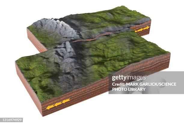
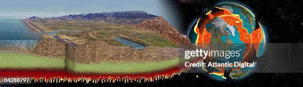
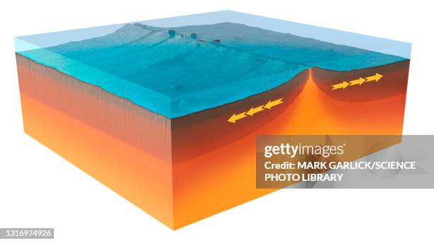
clastic rock formations showing mountains, glacier, river delta, lake, desert, sea and strata, cross-section, elevated view - fault geology stock illustrations
San Francisco: San Francisco Suburb. To paraphrase Charles Darwin, a bad earthquake in one second of time creates in the mind of a strange idea of...
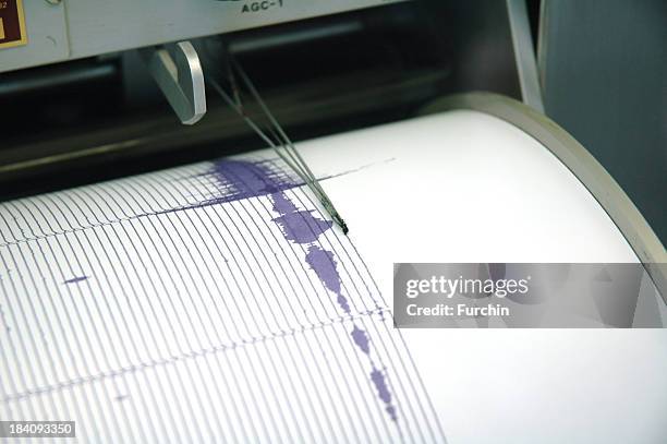
earthquake seismogram recording by a seismograph image - fault geology stock pictures, royalty-free photos & images
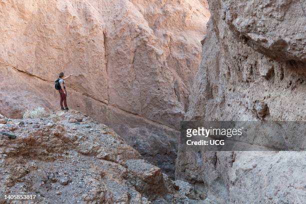
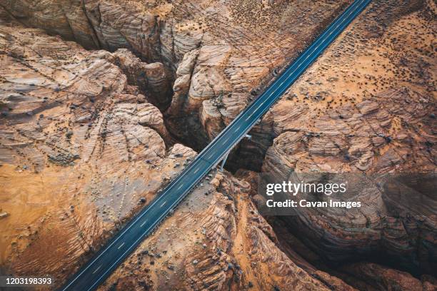
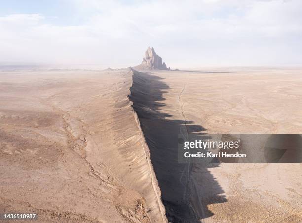
a slot canyon with a crossing road in arizona - fault geology stock pictures, royalty-free photos & images
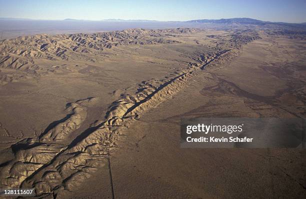
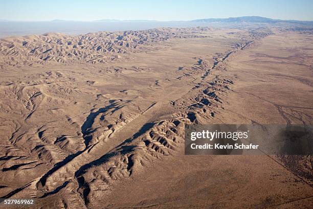
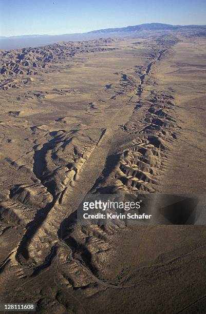
san andreas fault. aerial fault easily visible at surface on carrizo plain, south california - fault geology stock pictures, royalty-free photos & images
a photographer captures the fault rupture in the village. - fault geology stock pictures, royalty-free photos & images
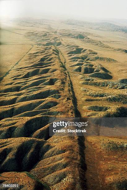
Movement along the infamous San Andreas Fault during big earthquakes has turned Wallace Creek into a "Z" shape as the tectonic plate on the right...
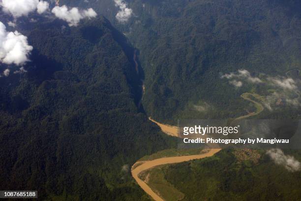
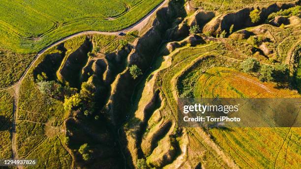
aerial view of ravine in the river valley - fault geology stock pictures, royalty-free photos & images
In an aerial view from a drone, colorful minerals are seen on the Pacific Plate side of the San Andreas Fault, where it collides with the North...
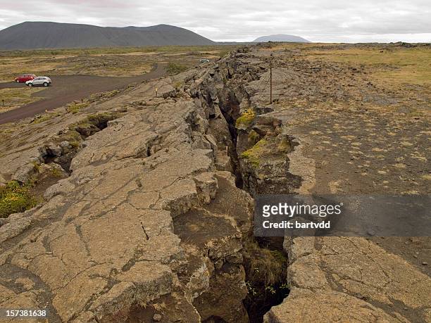
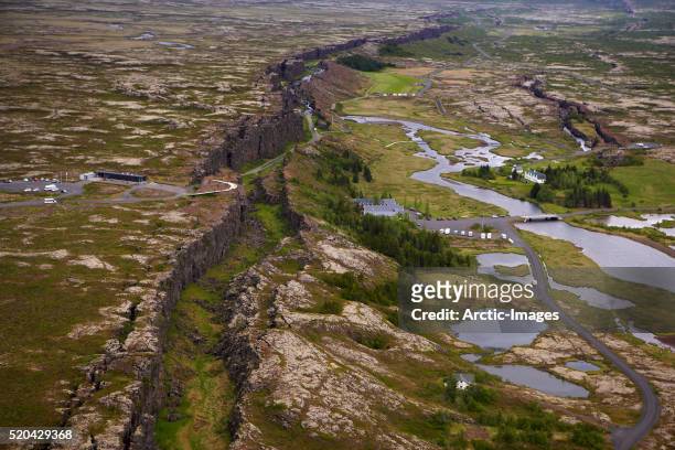
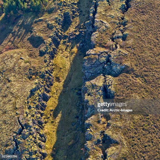
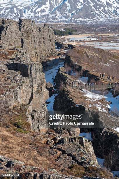
almannagja fissure, mid-atlantic ridge, iceland - fault geology stock pictures, royalty-free photos & images
mid-atlantic ridge fault line, thingvellir national park, iceland - fault geology stock pictures, royalty-free photos & images
california hills near the san andreas fault west of avenal, california - fault geology stock pictures, royalty-free photos & images
mid-atlantic ridge, almannagja fissure, thingvellir national park, iceland - fault geology stock pictures, royalty-free photos & images
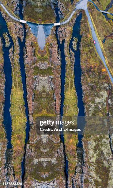
aerial drone view of unique landscape of fjadrargljufur in iceland. top tourism destination. fjadrargljufur canyon is a massive canyon about 100 meters deep and about 2 kilometers long, located in south east of iceland - fault geology stock pictures, royalty-free photos & images
a slot canyon with a crossing road in arizona - fault geology stock pictures, royalty-free photos & images
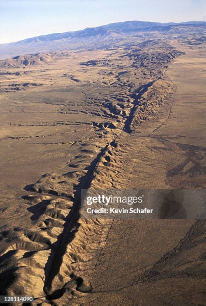
In an aerial view from a drone, the San Andreas Fault and Elkhorn Scarp are seen south of Carrizo Plain on March 28, 2021 north of New Cuyama,...
lava and moss, mid-atlantic ridge- flosagja fissure, iceland - fault geology stock pictures, royalty-free photos & images
aerial - lava and moss- thingvellir national park, iceland - fault geology stock pictures, royalty-free photos & images
septate cliff rock background with green - turquoise sea water in foreground - fault geology stock pictures, royalty-free photos & images
earthquake fault line from the sky at sunset in northern california - fault geology stock pictures, royalty-free photos & images
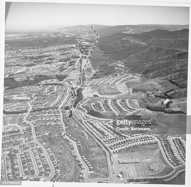
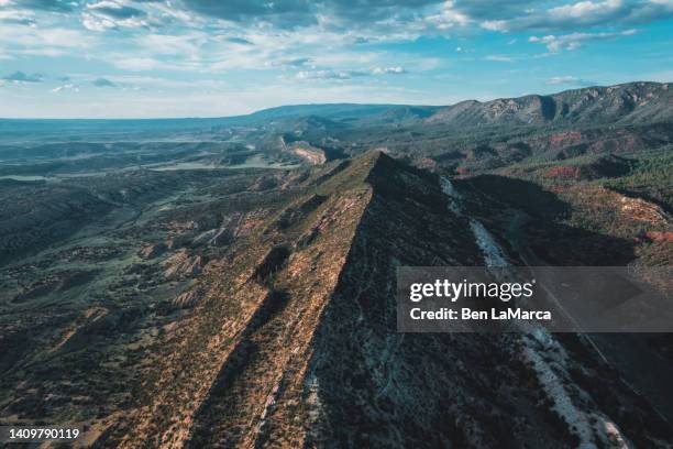
Aerial view of the Wasatch Mountain front near Kaysville and Farmington, Utah. The mountains rose along the potentially active Wasatch fault zone,...
people below high sandstone canyon walls near escalante river, utah - fault geology stock pictures, royalty-free photos & images
In an aerial view, wildflowers and green growth colorize the San Andreas Fault along the Elkhorn Scarp pressure ridge, formed by the grinding...
In an aerial view from a drone, the San Andreas Fault and Elkhorn Scarp are seen south of Carrizo Plain on March 28, 2021 north of New Cuyama,...
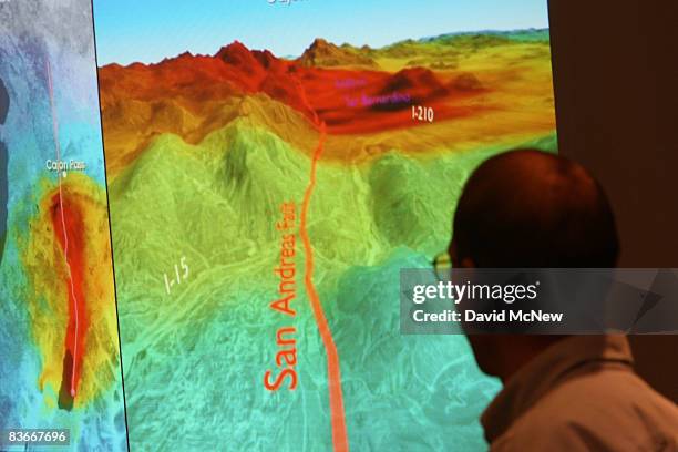
Research geophysicist with the United States Geological Survey Brad Aagaard shows members of the media a series of images that illustrate how shock...